
 | ||
Ca 14 south antelope valley freeway soledad canyon
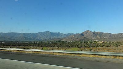
Soledad Canyon is a long narrow canyon/valley located in Los Angeles County, California between the cities of Palmdale and Santa Clarita. It is a part of the Santa Clara River Valley, and extends from the top of Soledad Pass to the open plain of the Valley in Valencia. The upstream section of the Santa Clara River runs through it.
Contents
- Ca 14 south antelope valley freeway soledad canyon
- Map of Soledad Canyon Santa Clarita CA 91355 USA
- GeographyEdit
- HistoryEdit
- References
Map of Soledad Canyon, Santa Clarita, CA 91355, USA
GeographyEdit
The canyon lies between the Sierra Pelona Mountains towards the northwest and the San Gabriel Mountains to the southeast, starting at the northeastern end of Santa Clarita Valley. As you travel northeast through the canyon, it gradually slopes up until you reach the unincorporated community of Acton, near which the Santa Clara River continues east towards its headwaters among the San Gabriel Mountains. Turning north towards Palmdale, the canyon terminates at Soledad Pass, just a few miles south of Lake Palmdale.
Soledad Canyon also contains the localities of Vincent, Acton, Ravenna, Russ, and Agua Dulce.
It is traversed by the Soledad Canyon Road (the second longest street in Santa Clarita), the Antelope Valley Freeway, and the Metrolink Antelope Valley Line. Travelers on board the Metrolink are afforded a view of much of the Santa Clara River.
HistoryEdit
Soledad Canyon was a vital part of Los Angeles' transportation history. Transit between Los Angeles and the Central Valley was always difficult–in the "Gold Rush era" and stagecoach days the ride was extremely difficult, almost straight up-and-down through San Fernando Pass, up San Francisquito canyon, and over Tejon Pass. In 1856, Lieutenant Williamson, on a railroad surveying party, "discovered" that the pass, sometimes named "Williamson Pass", could provide the lower grades to make Los Angeles–Central Valley train travel possible by the roundabout detour all the way to Mojave, and over Tehachapi Pass, almost 70 miles farther than the direct Interstate 5 used today by trucks and autos.
In 1876, seven years after the transcontinental railroad was finished, the rail line was laid down Soledad Canyon, linking LA to the north, after a 6,940 feet (2.12 km) tunnel through San Fernando pass (still used by Metrolink) and the Tehachapi Loop, where trains circle on grades over top of themselves to gain altitude.
In the near future, the canyon will serve as the route for the planned California High-Speed Rail line between Sylmar and Palmdale.