
Founded 19 January 1602 Area 600.1 km² Population 9,812 (2015) | Elevation 2,443 m (8,015 ft) Urban area 100 ha Local time Saturday 10:22 AM | |
 | ||
Founded by Gonzalo Sánchez de Flandes Time zone Colombia Standard Time (UTC-5) Weather 19°C, Wind NE at 8 km/h, 73% Humidity | ||
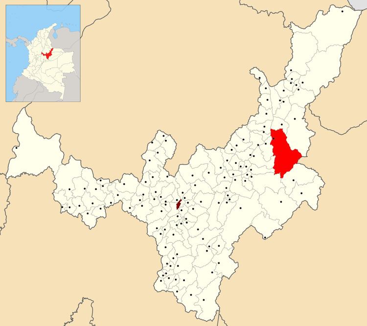
Socotá is a town and municipality in the Valderrama Province, part of the Colombian department of Boyacá. The municipality is situated in the Eastern Ranges of the Colombian Andes. The urban centre is at an altitude of 2,443 metres (8,015 ft) at a distance of 134 kilometres (83 mi) from the department capital Tunja. It borders Jericó and Sativanorte in the north, Pisba and Mongua in the south, Chita and Támara, Casanare in the east and Sativasur, Tasco, Socha and Gámeza in the west.
Contents
Map of Socot%C3%A1, Boyac%C3%A1, Colombia
Etymology
The name Socotá comes from Chibcha and means either "Land of the Sun and farmfields" or "Good harvest".
History
Before the Spanish conquest, Socotá was the northeasternmost part of the loose Muisca Confederation. It was ruled either by the iraca of Sugamuxi or by the Tundama based in Tundama.
Modern Socotá was founded on January 19, 1602 by Gonzalo Sanchez de Flandes.
Economy
Main economic activity of Socotá is livestock farming and on a minor scale coal mining.