
Founded 15 October 1577 Elevation 2,530 m Population 6,361 (2015) | Website Official website Area 167 km² Local time Monday 12:03 AM | |
 | ||
Time zone Colombia Standard Time (UTC-5) Weather 14°C, Wind NW at 2 km/h, 89% Humidity | ||
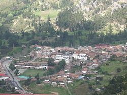
Tasco is a town and municipality in the Valderrama Province, part of the Colombian department of Boyacá. Tasco is situated on the Altiplano Cundiboyacense at altitudes ranging from 2,400 metres (7,900 ft) to 3,800 metres (12,500 ft). The Chicamocha River flows through the municipality which borders Socha in the north, Corrales and Gámeza in the south, Socotá in the east and Betéitiva and Paz de Río in the west. The urban centre is located at an altitude of 2,530 metres (8,300 ft) at 115 kilometres (71 mi) from the department capital Tunja.
Contents
Map of Tasco, Boyac%C3%A1, Colombia
Etymology
Tasco in the Chibcha language of the Muisca means "Enclosure or mansion of the sovereign".
History
The area of Tasco was inhabited by the Boche and Pirgua tribes, before the Spanish conquest of the Muisca. Modern Tasco was founded on October 15, 1577. Mummies have been encountered in Tasco.
Economy
Main economical activities of Tasco are agriculture and livestock farming. Among the agricultural products are potatoes, Ullucus tuberosus, turnips, maize, beans, barley, peas and chick peas. Fruits cultivated in Tasco are peaches, pears, prunes, apples and the Colombian fruit curuba.
Paleontology
Fossil remains of the Rosidae Berhamniphyllum and Archaeopaliurus boyacensis have been found in the Maastrichtian Guaduas Formation in Tasco and described in 2010.