
- min 99 m/s (3,496 cu ft/s) Discharge 412 m³/s Basin area 225,000 km² | Length 354 km Basin area 225,000 km² | |
 | ||
- average 412 m/s (14,550 cu ft/s) - max 680 m/s (24,014 cu ft/s) | ||
The Sobat River is a river of the Greater Upper Nile region in northeastern South Sudan, Africa. It is the most southerly of the great eastern tributaries of the White Nile, before the confluence with the Blue Nile.
Contents
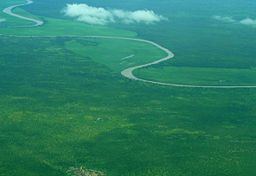
Map of Sobat, South Sudan
Geography
The Sobat River is formed by the confluence of the west-flowing Baro River and the north-flowing Pibor River, on the border with Ethiopia. The river enters the White Nile at Doleib Hill, near the city of Malakal in Upper Nile State.
When in flood the Sobat River produces an enormous discharge carrying a white sediment, which gives the White Nile its name.(registration required)
Hydrology
The Sobat and its tributaries drain a watershed approximately 225,000 km2 (87,000 sq mi) in size. The river's mean annual discharge is 412 m³/s (14,550 ft³/s).