
Country United States County Miami-Dade FIPS code 12-36100 Area 42.2 km² Elevation 4 m Area code Area codes 305 and 786 | State Florida Time zone Eastern (EST) (UTC-5) GNIS feature ID 0285050 Metropolitan area 15,895 km² Population 75,371 (1 Apr 2010) Mayor Carlos A. Giménez | |
 | ||
Kendall is a census-designated place and unincorporated community in Miami-Dade County, Florida, United States. As of the 2010 census, the area had a total population of 75,371.
Contents
- Map of Kendall FL USA
- Media
- History
- Geography
- Climate
- Demographics
- Transportation
- Economy
- Government and infrastructure
- Notable people
- Public schools
- Private schools
- Colleges and universities
- References
Map of Kendall, FL, USA
While the US Census Bureau has defined the boundaries of Kendall, many locals have their own definitions. Some believe the communities of West Kendall, Glenvar Heights, Sunset, Olympia Heights, Westwood Lakes and Tamiami to all be sub-communities of Kendall, while some people also believe the neighborhood of The Falls to be a separate entity.
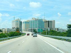
Kendall is served by the Miami Metrorail at Dadeland North and Dadeland South stations in its northeastern end. Both stations provide metro service from Dadeland to Miami commercial centers like Coral Gables, Downtown Miami, and Miami International Airport. Dadeland South station is a major transit depot in the area, connecting the southernmost suburbs of Homestead and Florida City to Metrorail via limited-stop bus rapid transit along the South Miami-Dade Busway.
Media
West Kendall is served by the Miami market for local radio and television. Kendall has its own newspaper, The Kendall Gazette, which is published twice monthly and is part of Miami Community Newspapers.
History
Much of what is now Kendall was purchased from the State of Florida in 1883 by the Florida Land and Mortgage Company. It was named for Henry John Broughton Kendall, a director of Florida Land and Mortgage who moved to the area in the 1900s to manage the company's land. As the land was not open to homesteading, development was slow well into the 20th century. A post office opened in 1914, and the first school opened in 1929. After the end of the land boom in 1926, some residents left. Two Seminole camps were in the Kendall area, and Seminoles continued to live there into the 1940s.
In August 1992, Kendall and the surrounding South Miami-Dade area were severely damaged by Hurricane Andrew. Many of the homes and businesses in the area were completely destroyed. In the subsequent years, the area was slowly rebuilt.
Geography
Kendall is located at 25°40′0″N 80°21′24″W (25.666781, −80.356533).
According to the United States Census Bureau, the Kendall region has an approximate total area of 16.3 sq mi (42.3 km2); 16.1 sq mi (41.8 km2) of it is land and 0.23 sq mi (0.6 km2) of it (1.35%) is water.
Climate
Climate in Kendall is naturally similar to the remainder of Miami-Dade County, although its location and elevation inland along the Miami Rock Ridge does make it slightly cooler at night during the winter and slightly warmer during the day in the summer.
Demographics
As of 2010, there were 31,899 households, and 8.7% were vacant. As of 2000, 33.4% households had children under the age of 18 living with them, 51.0% were married couples living together, 13.8% had a female householder with no husband present, and 31.0% were non-families. 24.4% of all households were made up of individuals and 7.3% had someone living alone who was 65 years of age or older. The average household size was 2.61 and the average family size was 3.14.
In 2000, the region's population was spread out with 23.3% under the age of 18, 8.6% from 18 to 24, 31.8% from 25 to 44, 24.9% from 45 to 64, and 11.5% who were 65 years of age or older. The median age was 37 years. For every 100 females there were 88.5 males. For every 100 females age 18 and over, there were 83.4 males.
In 2000, the median income for a household in the area was $51,330, and the median income for a family was $61,241. Males had a median income of $42,875 versus $31,416 for females. The per capita income for the area was $27,914. About 5.7% of families and 8.6% of the population were below the poverty line, including 8.0% of those under age 18 and 10.9% of those age 65 or over.
As of 2000, speakers of Spanish as a first language accounted for 52.46% of all residents, while English speakers comprised 40.38%, Portuguese was 1.49%, French at 1.12%, and French Creole made up 0.95% of the population.
As of 2000, Kendall had the twenty-first highest percentage of Cuban residents in the US, with 21.31% of the populace. It had the twenty-fifth highest percentage of Colombian residents in the US, at 4.56% of the population, and the sixteenth highest percentage of Nicaraguan residents in the US, at 2.48% of its population. It also had the twenty-fifth most Peruvians in the US, at 2.01% (tied with Carteret, New Jersey,) while it had the tenth highest percentage of Venezuelan residents in the US, at 1.47% of the population. As a result of the city's large French community, the French American School of Miami is located in Kendall. Kendall is also the home of Sofigi.
Transportation
Kendall is served by Metrobus throughout the area, and by the Metrorail at:
Economy
Pollo Tropical has its headquarters in Dadeland, Kendall. The headquarters moved to Dadeland in 1994.
Kendall is home to Dadeland Mall, an upscale indoor shopping mall in East Kendall with the following anchor stores: Macy's, Nordstrom, Saks Fifth Avenue, and JCPenney. And in South Kendall, Directly south of Dadeland Mall, on US-1 is The Falls an open-air shopping mall with anchor stores: Macy's, Bloomingdales as well as a Regal Cinema.
Prior to its dissolution Air Florida was headquartered in the Dade Towers in what is now the Kendall CDP.
Government and infrastructure
The Miami-Dade Police Department operates the Kendall District Station in the CDP.
Notable people
Public schools
The first public school in Kendall was Kendall School, now renamed Kenwood K-8 Center. Kenwood is the site of the Kenwoods Hammock, a native forest planting which has become a world-renowned stop for bird watchers.
Miami-Dade County Public Schools serves Kendall.
Miami Killian High School is in the CDP. In addition Miami Palmetto High School in Pinecrest serves a portion of the CDP.