
Region | Area 12.56 sq mi Population 122,000 (2006) | |
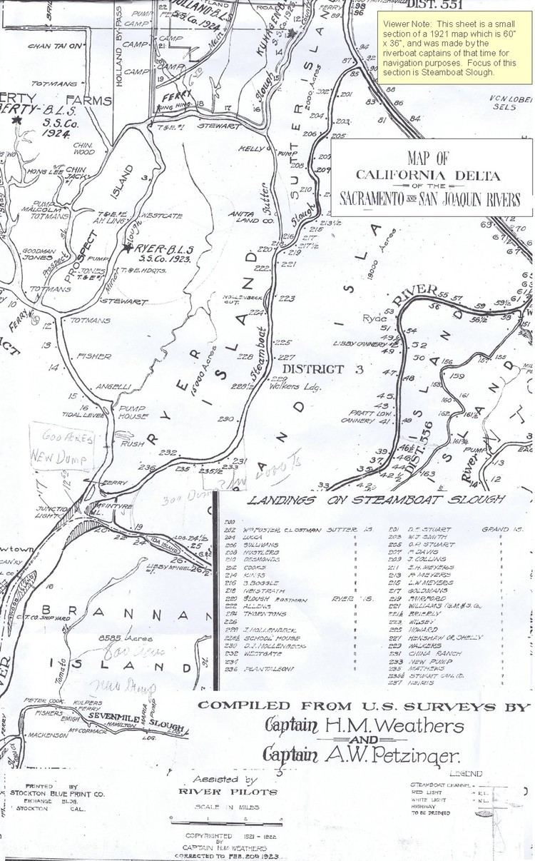 | ||
Map of Slough
Slough is a large town in Berkshire, England, on the western fringes of the Greater London Urban Area, 20 miles (32 km) west of central London, 3 miles (5 km) north of Windsor, 6 miles (10 km) east of Maidenhead, 12 miles (19 km) south-east of High Wycombe and 20 miles (32 km) north-east of Reading. Sitting at the gateway between the Thames Valley and London and at the intersection of the M4, M40 and M25 motorways, it offers easy road access to the rest of the UK.
Contents
- Map of Slough
- Best restaurant in slough berkshire
- Wildlife viewing at elkhorn slough
- History
- Redevelopment
- Geography
- Climate
- Demography
- Boundaries
- Town twinning
- Economy
- Road transport
- Rail transport
- Cycling
- Sports
- Education
- Negative perceptions
- References
The A4 and the Great Western Main Line pass through the town, which was historically part of neighbouring Buckinghamshire. From 2019 the Elizabeth Line (Crossrail) will allow fast journeys to central London.
As of 2011 Slough's population was one of the most ethnically diverse in the United Kingdom. with the highest proportion of religious adherents in England. The town has attracted people from across the country and the world for labour since the 1920s, which has helped shape it into a major trading centre. As of 2017 unemployment stood at 1.4%, circa one-third the UK average of 4.5%.
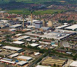
Slough has the highest concentration of global corporate HQs outside London. Slough is home to the Slough Trading Estate, wholly owned and managed by SEGRO, and the largest industrial estate in single private ownership in Europe. Blackberry, McAfee, Burger King and LEGO have head offices in the town. The Slough Trading Estate provides over 17,000 jobs in 400 businesses. Slough has the second highest gross value added per worker of cities in UK.
Best restaurant in slough berkshire
Wildlife viewing at elkhorn slough
History
The name, which means "soil", was first recorded in 1195 as Slo. It first seems to have applied to a hamlet between Upton to the east and Chalvey to the west, roughly around the "Crown Crossroads" where the road to Windsor (now the A332) met the Great West Road. The Domesday Survey of 1086 refers to Upton, and a wood for 200 pigs, worth £15. During the 13th century, King Henry III had a palace at Cippenham. Parts of Upton Court were built in 1325, while St Mary the Virgin Church in Langley was probably built in the late 11th or early 12th century, though it has been rebuilt and enlarged several times.
From the mid-17th century, stagecoaches began to pass through Slough and Salt Hill, which became locations for the second stage to change horses on the journey out from London. By 1838 and the opening of the Great Western Railway, Upton-cum-Chalvey's parish population had reached 1,502. In 1849, a branch line was completed from Slough railway station to Windsor and Eton Central railway station, opposite Windsor Castle, for the Queen's convenience.
Slough has 96 listed buildings. There are
1918 saw a large area of agricultural land to the west of Slough developed as an army motor repair depot, used to store and repair huge numbers of motor vehicles coming back from the battlefields of the First World War in Flanders. In April 1920, the Government sold the site and its contents to the Slough Trading Co. Ltd. Repair of ex-army vehicles continued until 1925, when the Slough Trading Company Act was passed allowing the company (renamed Slough Estates Ltd) to establish an industrial estate. Spectacular growth and employment ensued, with Slough attracting workers from many parts of the UK and abroad.
During the Second World War, Slough experienced a series of air raids, mostly in October 1940 (the largest number of people, five, dying as a result of one on the 13th), and an emergency hospital treating casualties from London was set up in Slough. Local air raid deaths and deaths at the hospital account for the 23 civilian lives recorded lost in the borough area.
After the war, several further large housing developments arose to take large numbers of people migrating from war-damaged London.
Redevelopment
In the 21st century, Slough has seen major redevelopment of the town centre. Old buildings are being replaced with new offices and shopping complexes. Tesco has replaced an existing superstore with a larger Tesco Extra. The Heart of Slough Project is a plan for the large-scale redevelopment of the town centre as a focus and cultural quarter for the creative media, information and communications industries. It will create a mixed-use complex, multi-functional buildings, visual landmarks and a public space in the Thames Valley. Recommendations for the £400 million project have been approved, and planning approval was given by Slough Borough Council's planning committee on 9 July 2009. Work began in 2010 for completion in 2018.
In December 2009, two key components of the project were signed: the Homes and Communities Agency (HCA) signed its agreement to provide £11m of funding for infrastructure and Thames Valley University (TVU) courses which are due to remain in the town have found a new home at the Centre in Farnham Road, Slough. In parallel to the town centre redevelopment plan, SEGRO (owner of the Slough Trading Estate) plans to spend £600 million over the next 20 years on the trading estate. This is intended to create environmentally sustainable buildings, open green spaces, two hotels, a conference centre, cafés, restaurants and better transport facilities to improve links to Slough town centre and the surrounding residential areas. It is claimed that the plan will create more than 4,100 new jobs and contribute around £100m a year to Slough's economy. If both plans go ahead in their current forms, nearly £1 billion will be spent on redeveloping Slough over the next 20 years.
Herschel Park (known as Upton Park until 1949), named for astronomer William Herschel, is currently being relandscaped in a multimillion-pound effort to bring it back to its former Victorian era glory. The park was featured in an episode of the documentary programme Who Do You Think You Are? focusing on the TV presenter Davina McCall.
In 2010, £2 million was set aside to improve disabled access to Slough railway station in preparation for an expected increase in use during the 2012 London Olympics. Preparations were under way for the regeneration of the Britwell suburb of Slough, involving tearing down a dilapidated block of flats and the closing of the public house the Jolly Londoner in Wentworth Avenue and replacing them with new homes, as well as relocating the shopping parade in the street to nearby Kennedy Park. As part of the Heart of Slough project, construction work on a new bus station began in March 2010 following weeks of demolition work to half of the existing bus station and the removal of Compair House near the railway station; it was expected to be completed by January 2011 and was opened in May 2011, 5 months behind schedule.
Redevelopment on this scale has been strongly criticised by conservation groups. The Twentieth Century Society has stated that
"[A] tragically high quantity of good buildings have been demolished in Slough in recent years, including grand Art-Deco-styled factories by the likes of Wallis Gilbert and high-quality post-war offices. More are to come down as the town tries to erase its past and reinvent itself from scratch. Despite famously heckling Slough, John Betjeman's praise for the town hall's architecture as 'a striving for unity out of chaos' in 1948 has never been so relevant as today. C20 believes that the redevelopment of the town hall would be an act of vandalism to the civic centre and is supporting the Campaign to Save Slough's Heritage in their request for a review of the decision."
During November 2016, the Slough Queensmere and Observatory shopping centres were sold to Abu Dhabi Investment Authority (ADIA) in a deal worth £130million.
Geography
Slough is to the west of Greater London. Nearby towns are Windsor to the south, Maidenhead to the west, Uxbridge to the northeast and Beaconsfield to the north.
Most of the area that now makes up Slough was anciently part of Buckinghamshire. The town developed by the expansion and amalgamation of villages along the Great West Road. Over the years Slough has expanded greatly, incorporating a number of different villages. Original villages that are now suburbs of Slough include Chalvey, Cippenham, Colnbrook, Langley, Poyle, Upton, and Wexham.
Named neighbourhoods include Brands Hill, Britwell, Huntercombe, Manor Park, Salt Hill, Upton Lea and Windsor Meadows. The urban area merges into the neighbouring parishes of Burnham, a small area of Taplow near Cippenham, Farnham Royal and Stoke Poges which remain in the county of Buckinghamshire and Datchet which is also in Berkshire. Eton is narrowly buffered by the Jubilee River and by green space (mainly the college playing fields) from part of Slough, and the two areas formerly formed the Eton birth, marriages and deaths registration district.
Climate
The nearest Met Office weather observing station to Slough is London Heathrow Airport, about 5 miles (8 km) east of Slough town centre. This part of the Thames Valley is notable for generally having the warmest daytime summer temperatures on average in the British Isles. Typically, according to 1981–2010 normals, the average high temperature in July is 23.5 °C (74.3 °F.)
Rainfall is low compared to most of the British Isles, with under 600 mm (23.62 in) annually, and 105 days reporting over 1 mm of rain.
Demography
During the Great Depression of the 1930s, Slough became a haven for the unemployed Welsh, who walked up the Great West Road looking for employment.
According to the 2011 census, 45.7% of the population was White (34.5% White British, 1.1% White Irish, 0.2% Gypsy or Irish Traveller, 9.9% Other White), 3.4% of mixed race (1.2% White and Black Caribbean, 0.4% White and Black African, 1.0% White and Asian, 0.8% Other Mixed), 39.7% Asian (17.7% Pakistani, 15.6% Indian, 0.4% Bangladeshi, 0.6% Chinese, 5.4% Other Asian), 8.6% Black (5.4% African, 2.2% Caribbean, 1.0% Other Black), 0.7% Arab and 1.9% of other ethnic heritage. In the post-war years, immigrants from the Commonwealth, notably Anguilla, Antigua and Barbuda, India and Pakistan were attracted to the town.
In the early 1950s, there were a number of Polish refugee camps scattered around the Slough area. As returning to Poland (then in the Soviet Bloc) was not considered an option by many of the wartime refugees, many Polish families decided to settle in Slough, an expanding town seeking committed workers and offering a chance to own homes for those prepared to work hard. In time, a Polish-speaking Roman Catholic parish was established with its own church building. A new wave of Polish migration to Slough has followed since Poland became part of the European Union.
Slough Council made history by electing the country's first black female mayor, Lydia Simmons, in 1984.
Figures from the 2011 census showed that 41.2% of Slough's population identified as Christian, 23.3% as Muslim, 10.6% as Sikh, 6.2% as Hindu, 0.5% as Buddhist, 0.1% as Jewish, 0.3% as having other religions, 12.1% as having no religion and 5.7% did not answer the question. Slough has the highest percentage of Sikh residents in the country according to the census figures. Slough also has the highest percentage of Muslim and Hindu residents in the South East region.
Boundaries
In 1863, Slough became a local government area when a Slough Local Board of Health was elected to represent what is now the central part of the modern Borough. This part of Upton-cum-Chalvey Civil Parish became Slough Urban Sanitary District in 1875. The functions of these two bodies were strengthened in 1894, when Slough Urban District was created, Buckinghamshire County Council having been created in the previous decade. In 1930, there was a major extension westward of the Urban District, and the area was divided into electoral wards for the first time (the new areas of Burnham (Beeches), Farnham (Royal) and Stoke (Poges) (commonly used suffixes) as well as the divisions of the old district Central, Chalvey, Langley and Upton). In 1938, the town became a Municipal Borough by Royal Charter.
Slough was transferred to Berkshire in the 1974 local government reorganisation. The old Municipal Borough was abolished and not deemed part of an urban conglomeration, replaced by a non-city type second-tier authority (Non-metropolitan district), which was however made a Borough by the town's second Royal Charter. Britwell and Wexham Court became part of Slough at this time, with their civil parish councils. On 1 April 1995, the Borough of Slough expanded slightly into Buckinghamshire and Surrey, to take in Colnbrook and Poyle and merged their civil parish councils.
Slough became a unitary authority, on 1 April 1998. This coincided with the abolition of Berkshire County Council and the dissolution of its Borough Status received under its second Royal Charter. However, to enable the continued use of the word Borough, as in some other parts of Berkshire, Slough received its third Royal Charter in 1998.
Since 2015, Slough has had a Youth Parliament to represent the views of younger people.
Town twinning
Slough is twinned with:
Economy
Before the 19th century, the main businesses of Slough were brickfields and agriculture. The bricks for the building of Eton College were made in Slough. Later, as the Great West Road traffic increased, inns and pubs sprang up along the road to service the passing trade. Until the town developed as an industrial area, nurseries were prominent in the local economy; the Cox's Orange Pippin apple was first raised in Colnbrook (not then within Slough) around 1825, and the dianthus "Mrs Sinkins Pink" was first raised at some point between 1868 and 1883 by John Sinkins, the master of the Eton Union Workhouse, which lay in Slough.
In the mid-19th century, the only major employer apart from the brickfields was James Elliman, who started as a draper in Chandos Street. In 1847, he changed business and manufactured his Elliman's Embrocation and Royal Embrocation horse liniment at factories in Wellington Street and Chandos Street. Elliman became a major benefactor to the town, and is remembered today in the names of local roads and schools.
In September 1851, William Thomas Buckland, an auctioneer and surveyor from nearby Wraysbury, began livestock sales in a field near the Great Western Road Railway Station belonging to the North Star Inn. Originally held on the first Tuesday of every month, the Cattle Market's popularity soon saw this increased to every Tuesday. A move to Wexham Street was necessitated by the postwar redevelopment of the town. The Slough Cattle Market was run by Messrs Buckland and Sons until its final closure in 1988.
In 1906, James Horlick, one of the eponymous founders of the malted milk company, opened a purpose-built red-brick factory near Slough Railway Station to manufacture his malted milk product.
Starting in the 1920s, Slough Estates Ltd, the operator of the original Slough Trading Estate, created and operated many more estates in the UK and abroad. The Slough Trading Estate meant that the town was largely insulated from many of the effects of recession. For many years, Slough's economy was mainly manufacturing-based.
In the last 20 or so years, there has been a major shift from a manufacturing to an information-based economy, with the closure of many factories (some of which had been in Slough for many decades). The factories are rapidly being replaced by office buildings. Hundreds of major companies have sited in Slough Trading Estate over the years, with its proximity to London Heathrow Airport and good motorway connections being attractive. In the 1960s, Gerry Anderson's film company was based in Slough, and his Supermarionation series, including Thunderbirds, were filmed there.
The UK headquarters of Mars, Incorporated is based in Slough, the main factory having been created in 1932 by Forrest Mars Sr.. He produced the Mars Bar in Slough over 70 years ago. One of the Mars factories has been demolished and some production has moved to the Czech Republic. The European head offices of major IT companies such as BlackBerry, McAfee, Computer Associates, PictureTel and Compusys (among others) are all in the town. O2 is headquartered in the town across four buildings. The town is also home to the business support organisation Thames Valley Chamber of Commerce Group and National Foundation for Educational Research, which is housed in the Mere.
Recent new offices include those of Nintendo, Black and Decker and Abbey business centres. Dulux paints are still manufactured in Slough by AkzoNobel, which bought Imperial Chemical Industries in 2008. The registered office of Furniture Village lies in the town. Sara Lee's headquarters for the United Kingdom are also in Slough.
The motor trade has long been represented in Slough. Until 1966, Citroën assembled cars in a Liverpool Road factory (later used by Mars Confectionery), and it retains its UK headquarters in the town. Ford built D Series and Cargo lorries at its factory in Langley (a former Hawker Aircraft site) from 1936 to the 1950s) until the site was redeveloped for housing in the 1990s. Ferrari, Mercedes, Fiat and Maserati now have offices in the town.
Road transport
Slough is near London, Heathrow Airport, Uxbridge, Maidenhead and Staines and the town is a travel hub. Many people from Slough work in nearby towns and cities such as Windsor, Reading, London and Bracknell, and there are large passenger movements in the morning and evening rush hours. Road transport in Slough includes:
Rail transport
Slough is served by First Great Western stations at Burnham, Slough and Langley. Slough station is a junction between the Great Western Main Line and the Slough to Windsor & Eton Line to allow passengers to connect for Windsor & Eton Central.
Reading: First Great Western operate services to Reading every half an hour which take 20 minutes.
London Paddington: First Great Western operate express services to London every half an hour which take 17 minutes.
Slough will have Crossrail services, a new railway line across central London, under construction. The Windsor Link Railway is another proposed railway line that would link Slough to Heathrow Terminal 5 via Wraysbury, Datchet, Windsor and Chalvey. The Western Rail Access to Heathrow, WRAtH, is a £500m rail project announced by the DfT. The proposed rail link would directly serve Slough with four trains every hour - reducing travel times from 45 to six minutes. It is expected to be operational by 2021. In February 2014, Network Rail announced the route for the project. The WRAtH project is expected to generate more than £2billion in economic benefits to the UK as well as 40,000 new jobs.
Cycling
National Cycle Network route 61 runs through central Slough. A Smoove bike sharing system was launched in October 2013, targeting commuters travelling between the trading estate and nearby railway stations.
Sports
Slough has a senior non-League football team, Slough Town F.C., who currently play in the Southern Football League Premier Division, which is the 7th tier of football in England.
Slough Hockey Club – The Ladies 1XI are currently in the top tier of English Hockey. The Men's 1XI are in MBBO Regional 1 whereas the Men's 2XI are in MBBO Division 3.
Slough Rugby Club are currently in the 5th Tier of the Rugby Union system.
The town has produced many Olympic class athletes as part of the 'Windsor, Slough, Eton and Hounslow Athletics Club' (see List of people from Slough, Berkshire).
Education
There are numerous primary and secondary schools serving Slough. In addition, East Berkshire College has a campus in the area. Slough schools are in the top 10 best performers in the country at GCSE level. In 2011, 68.1% of pupils left school with a minimum of 5 A*-C grades (with English and maths). The national average is 58.9%.
Thames Valley University (Slough Campus) is currently closed due to the Heart of Slough project. The new campus was scheduled to be opened in 2013 as part of the University of West London which is the new name for Thames Valley University; however, as of January 2014, the redevelopment of the site still has yet to get underway.