
Airport type Public 18/36 5,001 Elevation 9 m | Owner City of Slidell Elevation AMSL 29 ft / 9 m 5,001 1,524 Phone +1 985-641-7590 | |
 | ||
Address 62512 Airport Rd, Slidell, LA 70460, USA | ||
Slidell Airport (ICAO: KASD, FAA LID: ASD) is a city-owned public-use airport located four nautical miles (7 km) northwest of the central business district of Slidell, a city in St. Tammany Parish, Louisiana, United States.
Contents
- St tammany mosquito control plane crashes north of slidell airport chief randy smith update
- Facilities and aircraft
- References
Although most U.S. airports use the same three-letter location identifier for the FAA and IATA, this airport is assigned ASD by the FAA but has no designation from the IATA (which assigned ASD to Andros Town Airport on Andros Island in the Bahamas).
St tammany mosquito control plane crashes north of slidell airport chief randy smith update
Facilities and aircraft
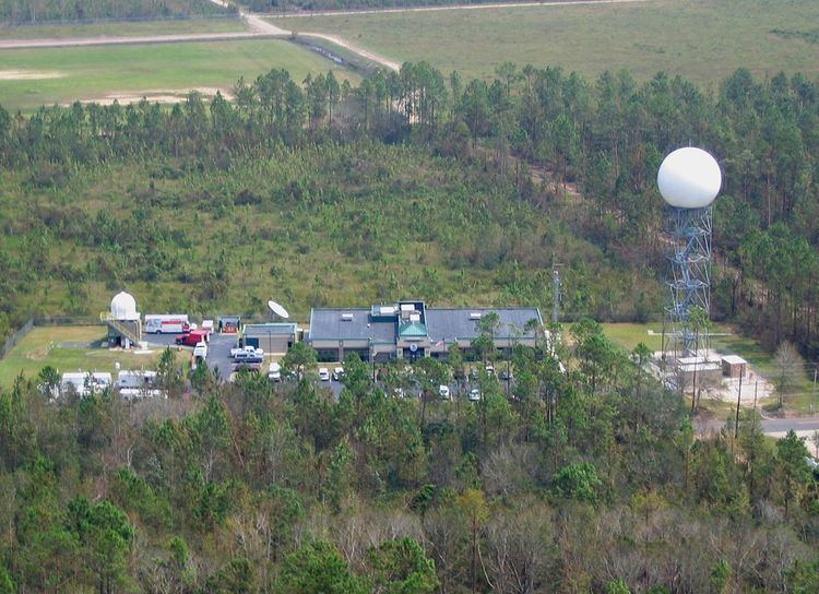
Slidell Airport covers an area of 340 acres (140 ha) at an elevation of 29 feet (9 m) above mean sea level. It has one runway designated 18/36 with a 5,001 by 100 ft (1,524 x 30 m) asphalt surface. The Louisiana Office of the National Weather Service is colocated.
For the 12-month period ending April 15, 2008, the airport had 112,000 aircraft operations, an average of 306 per day: 96% general aviation, 4% military. At that time there were 86 aircraft based at this airport: 87% single-engine, 9% multi-engine, 2% helicopter and 1% jet.