
Basin area 91.58 km² | - elevation 2,364 ft (721 m) - elevation 1,411 ft (430 m) | |
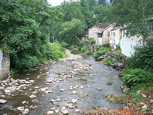 | ||
The Slab Fork is a tributary of the Guyandotte River, 15.1 miles (24.3 km) long, in southern West Virginia in the United States. Via the Guyandotte and Ohio rivers, it is part of the watershed of the Mississippi River, draining an area of 35.36 square miles (91.6 km2) in a mainly rural area on the unglaciated portion of the Allegheny Plateau.
Map of Slab Fork, West Virginia, USA
The Slab Fork rises in Raleigh County, approximately 2 miles (3.2 km) south of Lester and 2.5 miles (4.0 km) west of Sophia, and initially flows generally southwestward through the communities of Slab Fork and Hotchkiss into eastern Wyoming County, where it turns southward and flows through the communities of Maben, Pierpont, and Otsego, to the city of Mullens, where it flows into the Guyandotte River from the north. Between Slab Fork and Mullens, the stream is paralleled by West Virginia Route 54.
According to 1992 data from the United States Geological Survey, approximately 95% of the Slab Fork watershed was forested; approximately 2% was used for agriculture; and approximately 1% was used for commercial or mining purposes.