
Country United States FIPS code 54-46468 Elevation 621 m Zip code 25865 Local time Wednesday 11:42 PM | Time zone Eastern (EST) (UTC-5) GNIS feature ID 1554946 Area 129 ha Population 339 (2013) Area code 304 | |
 | ||
Weather -5°C, Wind NW at 21 km/h, 49% Humidity | ||
Lester is a town in Raleigh County, West Virginia, United States. The population was 348 at the 2010 census. The community was named after Champ Lester, a local pioneer.
Contents
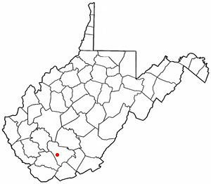
Map of Lester, WV, USA
Geography
Lester is located at 37°44′5″N 81°18′4″W (37.734740, -81.300985).
According to the United States Census Bureau, the town has a total area of 0.50 square miles (1.29 km2), all of it land.
2010 census
As of the census of 2010, there were 348 people, 143 households, and 95 families residing in the town. The population density was 696.0 inhabitants per square mile (268.7/km2). There were 175 housing units at an average density of 350.0 per square mile (135.1/km2). The racial makeup of the town was 83.9% White, 13.8% African American, 0.3% Native American, and 2.0% from two or more races. Hispanic or Latino of any race were 0.3% of the population.
There were 143 households of which 31.5% had children under the age of 18 living with them, 51.0% were married couples living together, 8.4% had a female householder with no husband present, 7.0% had a male householder with no wife present, and 33.6% were non-families. 28.7% of all households were made up of individuals and 15.4% had someone living alone who was 65 years of age or older. The average household size was 2.43 and the average family size was 2.89.
The median age in the town was 40.1 years. 25.3% of residents were under the age of 18; 6.3% were between the ages of 18 and 24; 25% were from 25 to 44; 25.3% were from 45 to 64; and 18.1% were 65 years of age or older. The gender makeup of the town was 49.1% male and 50.9% female.
2000 census
As of the census of 2000, there were 322 people, 142 households, and 89 families residing in the town. The population density was 650.5 inhabitants per square mile (248.6/km²). There were 168 housing units at an average density of 339.4 per square mile (129.7/km²). The racial makeup of the town was 79.81% White, 19.88% African American, and 0.31% from two or more races.
There were 142 households out of which 23.9% had children under the age of 18 living with them, 47.2% were married couples living together, 11.3% had a female householder with no husband present, and 37.3% were non-families. 33.1% of all households were made up of individuals and 19.0% had someone living alone who was 65 years of age or older. The average household size was 2.27 and the average family size was 2.91.
In the town, the population was spread out with 20.2% under the age of 18, 9.3% from 18 to 24, 26.1% from 25 to 44, 27.3% from 45 to 64, and 17.1% who were 65 years of age or older. The median age was 42 years. For every 100 females there were 86.1 males. For every 100 females age 18 and over, there were 79.7 males.
The median income for a household in the town was $24,375, and the median income for a family was $30,938. Males had a median income of $25,208 versus $18,125 for females. The per capita income for the town was $11,026. About 14.6% of families and 15.7% of the population were below the poverty line, including 19.7% of those under age 18 and 19.7% of those age 65 or over.