
Length 98 km | ||
 | ||
The Sjoa river provides the outlet from lake Gjende at Gjendesheim in the Jotunheimen mountains of Norway's Jotunheim National Park. It flows eastward into the Gudbrandsdalslågen river via the Heidal traditional district in the Gudbrandsdal.
Contents
Map of Sjoa, Norway
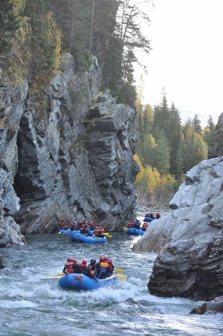
South of the village Randsverk it flows through Ridderspranget—a ravine named after a Norwegian myth.
Tourism
The scenery and traditions of Heidal, attracts tourists.
Rafting, kayaking and fishing
The river is used for kayaking, rafting and fishing. Thirteen deaths have occurred in the river, from 1989 to 2010 (including four deaths involving a group of tourists in various inflatable "catarafts", on 24 July 2010; the level of the river was at the time 10 centimetres (4 in) above a safe level (for rafting), has been claimed by a national newspaper).
There are several companies offering rafting, kayaking, riverboarding and other activities in Sjoa and the surrounding area. Some parts of the river are impossible to raft. Some parts are blocked by large rocks which the river flows underneath. These areas are considered "death traps" by the local commercial rafting providers.