
Country Philippines District 3rd district Time zone PST (UTC+8) Area 141.3 km² Province Camarines Sur | Region Bicol (Region V) Barangays ZIP code 4427 Local time Thursday 9:11 AM | |
 | ||
Weather 29°C, Wind SE at 5 km/h, 72% Humidity | ||
Siruma is a fourth class municipality in the province of Camarines Sur, Philippines. According to the 2015 census, it has a population of 17,764 people.
Contents
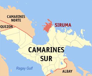
Map of Siruma, Camarines Sur, Philippines
History
Siruma belonged to several towns before it became an independent town of its own. Years back, the municipality of Siruma was under the jurisdiction of Quipayo, considered to be one of the oldest parishes in the Archdiocese of Nueva Caceres. Now, Quipayo is a barangay of Calabanga town.
On October 19, 1846, a decree was implemented by Governor General Narciso Claveria which restructured the territorial domain of the province. It was during this time that Siruma was ceded to Camarines Norte.
It was said that the town's name was derived from the name of an island called "Matandang Siruma". The word "siruma" comes from the local vernacular sirum which is a "small, red ant". A myth was told that a certain capitan encountered a swarm of small red ants during his overnight stay in one of the places in Siruma, thus, calling the place as "masirum".
Barangays
Siruma is politically subdivided into 22 barangays.
Demographics
In the 2015 census, the population of Siruma, Camarines Sur, was 17,764 people, with a density of 130 inhabitants per square kilometre or 340 inhabitants per square mile.