
Reference no. DE: 2448 | ||
 | ||
Main source near Oberwildfleckenca. 671 m above sea level (NN) Progression | ||
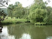
The Sinn is a river that flows through the state of Hesse and the Bavarian province of Lower Franconia in southern Germany. It is about 50 kilometres (31 mi) long and is a right, northerly tributary of the Franconian Saale.
Contents
- Map of Sinn Germany
- CourseEdit
- TributariesEdit
- Towns and villagesEdit
- SinnEdit
- Schmale SinnEdit
- NatureEdit
- References
Map of Sinn, Germany
CourseEdit
The Sinn emerges in the Franconian Rhön at the foot of the Kreuzberg near the local subdistrict (Gemarkung) of Neuwildflecken. At Zeitlofs on the Hessian-Lower Franconian border it flows into the Schmale Sinn which joins it from the Dammersfeldkuppe to the northeast.
Accompanied in places by the Würzburg−Fulda railway and crossed by the A 7 motorway bridge below Riedenberg, the Sinn initially flows in a southwesterly and then in a southerly direction to Gemünden, where it joins the Franconian Saale just under 700 m before the latter river discharges into the River Main.
TributariesEdit
The tributaries of the Sinn include (in downstream order): Oberbach, Schmale Sinn, Gronau, Jossa and Aura.
Towns and villagesEdit
The towns and villages along the Sinn and Schmale Sinn include (in downstream order):
SinnEdit
Wildflecken, Oberbach, Riedenberg, Bad Brückenau, Eckarts-Rupboden, Zeitlofs, Altengronau, Jossa, Obersinn, Mittelsinn, Burgsinn, Rieneck, Schaippach, Gemünden, (Oberzell).
Schmale SinnEdit
Kothen, Speicherz, the A 7 Grenzwald Bridge, Oberzell, Weichersbach, Mottgers
NatureEdit
The existence of the extremely rare Snake's Head Fritillary in the Sinn Valley has been recorded since the 19th century. This plant occurs at heights between 160 and 250 metres in various meadow communities, especially in the wet meadows of the two nature reserves that border one another: the Sinngrund near Obersinn and Sinnwiesen von Altengronau.