
 | ||
Similar | ||
Singalila ridge trek sunrise over himalayan giants part 3
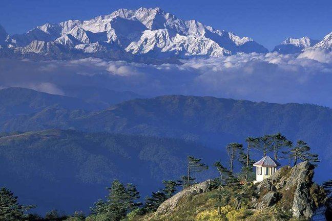
The Singalila Ridge is a north-south mountain ridge running from northwestern West Bengal through Sikkim in the Indian part of the Himalayas. The district of Ilam in Nepal falls on the western part of this ridge.
Contents
- Singalila ridge trek sunrise over himalayan giants part 3
- Map of Singalila Sikkim 737121
- Summits
- Films
- References
Map of Singalila, Sikkim 737121
The ridge separates mountain ranges of West Bengal from other Himalayan ranges to its west. The two highest peaks of West Bengal, Sandakphu (3,636 m (11,929 ft)) and Phalut (3,600 m (11,800 ft)) are located on the ridge. The Singalila National Park encompasses the ridge. It is noted for its views of Kanchenjunga and Mount Everest. The trek from Manebhanjan to Sandakphu and Phalut is popular amongst adventure travelers, as is mountain biking.
Summits
The four highest peaks are :
Films
Singalila In the Himalaya
References
Singalila Ridge Wikipedia(Text) CC BY-SA