
 | ||
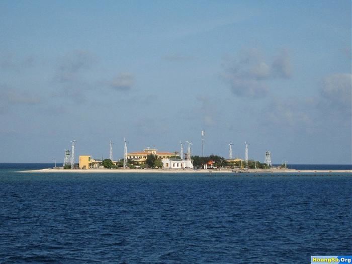
Sin Cowe Island, also known as Sinh Ton Island, (Tagalog: Rurok; Chinese: 景宏岛; pinyin: Jinghong Dao; Vietnamese: Đảo Sinh Tồn) is an island in the Spratly Islands in the South China Sea. With an area of 8 hectares (20 acres), it is the seventh largest Spratly island and the third largest of those occupied by Vietnam. It has a fringing reef which is above water at low tide.
Contents
Map of Sin Cowe Island
This island has been controlled by Vietnam since 1974, first by the Republic of Vietnam's ARVN Navy, followed by the Navy of the Socialist Republic of Vietnam after 1975. The island is also claimed by the People's Republic of China, the Republic of China (Taiwan) and the Philippines.
It is part of the Union Banks.
Topography and Structures
Sin Cowe island is inhabited by Vietnamese soldiers. The structures on it include a two-storied government building, anti aircraft guns, artillery and a Vietnamese Sovereignty marker.