
Elevation 500 m (1,600 ft) | Microregion Vão do Paranã Time zone BRT/BRST (UTC-3/-2) | |
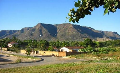 | ||
Simolândia is a municipality in northeast Goiás state, Brazil.
Contents
- Map of SimolC3A2ndia State of GoiC3A1s Brazil
- Location and Geography
- Demographic Information
- Economic Information
- Health and education
- References
Map of Simol%C3%A2ndia - State of Goi%C3%A1s, Brazil
Location and Geography
Simolândia is situated in the northeast of Goiás, at kilometer 250 of the important BR-020 (Belém-Brasília highway). It forms boundaries with Posse, Alvorada do Norte and Buritinópolis. It belongs to the Vão do Paranã statistical micro-region.
The distance to Goiânia is 460 km. Highway connections are made by BR-153 / Anápolis / BR-060 / Alexânia / Sobradinho / Planaltina / Formosa / BR-020 / BR-030 / BR-020 / Vila Boa / Alvorada do Norte.
The municipality lies mainly on the slopes of the Serra da Chapadinha and the topography is broken by several rivers: the Corrente, Salobro and Buriti, which are popular with tourists. The climate is hot and dry. The vegetation is made up of 60% forest and 40% savanna. Hardwoods are exported or used in the furniture industry.
Demographic Information
Economic Information
The economy is based on subsistence agriculture, cattle raising (19,100 head in 2006), services, public administration, and small transformation industries. There were no banks in 2007. There were 362 automobiles in 2007.
Agricultural data 2006
Health and education
Simolândia was ranked 233 out of 242 municipalities in the state of Goiás on the United Nations Human Development Index with a score of 0.657. Nationally it was ranked 3,649 out of 5,507 municipalities in 2000. (All data are from 2000.)