Rahul Sharma (Editor)

Sierra de Gata (comarca)

Updated on
Edit
Like
Comment
Share on FacebookTweet on TwitterShare on LinkedInShare on Reddit
Country
  
Spain

Municipalities
  
List See text

Largest municipality
  
Valverde del Fresno

Province
  
Province of Cáceres

Autonomous community
  
Extremadura

Time zone
  
CET (UTC+1)

Area
  
1,254 km²

Sierra de Gata (comarca) visitwesternspaincomwpcontentuploadssierra

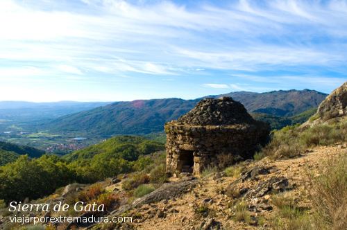
Sierra de Gata is a comarca at the northern end of province of Cáceres in Extremadura, one of Spain's seventeen Autonomous Communities. The mountain range of Sierra de Gata is in the area and has given its name to the comarca. The main town is Moraleja

Contents

Map of Sierra de Gata, C%C3%A1ceres, Spain

This comarca borders with Portugal in the west in the area of the Portuguese Serra da Malcata Natural Reserve. There are linguistic affinities between this comarca and neighboring Las Hurdes.

Municipal termsEdit

The traditional names of the towns and aldeas are in brackets.

  • Acebo (L'Acebu)
  • Cadalso (Cadarsu)
  • Cilleros (Cillerus)
  • Parrera
  • Descargamaría
  • Eljas (As Ellas)
  • El Soto (U Soitu)
  • Gata
  • Moheda de Gata (La Mueda)
  • Hernán Pérez (Jerranperris)
  • Hoyos (Joyus)
  • Moraleja
  • Cañadas
  • Malladas
  • La Mata
  • Pedrizas
  • Porciones
  • La Quinta
  • Rozacorderos
  • Perales del Puerto (Peralis)
  • Robledillo de Gata (Robleillu)
  • San Martín de Trevejo (Sa Martín de Trebellu)
  • Santibáñez el Alto (Santibañis l'Altu)
  • Torre de Don Miguel
  • Torrecilla de los Ángeles (Torrecilla de los Ángilis)
  • Valverde del Fresno (Valverdi du Fresnu)
  • Vegaviana
  • Villamiel
  • Trevejo (Treveju)
  • Villanueva de la Sierra (Villanueva)
  • Villasbuenas de Gata (Villasgüenas)
  • References

    Sierra de Gata (comarca) Wikipedia