
Prominence 540 m (1,770 ft) Elevation 1,124 m | Last eruption 2005 | |
 | ||
Similar Fernandina Island, Cerro Azul, Alcedo Volcano, Genovesa Island, Volcán Wolf | ||
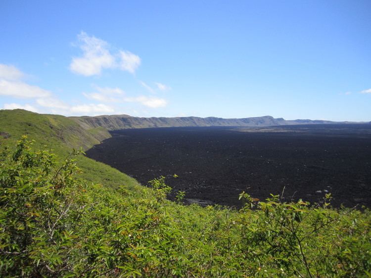
Ecuador galapagos sierra negra shield volcano crater
Sierra Negra (also, and perhaps more properly, Cerro La Negra) is an extinct volcano located in the Mexican state of Puebla, close to the border with Veracruz. At officially 4,580 metres (15,030 ft) above sea level, it is the fifth highest peak in Mexico. However, because it is overshadowed by nearby Pico de Orizaba (5,610 m/18,406 ft), it is not too well known and often left out of lists of Mexico's mountains.
Contents
- Ecuador galapagos sierra negra shield volcano crater
- Map of Sierra Negra Ecuador
- Sierra negra volcano isabela galapagos islands ecuador
- Overview
- References
Map of Sierra Negra, Ecuador
Sierra negra volcano isabela galapagos islands ecuador
Overview
Sierra Negra is located within the Pico de Orizaba National Park. The summit is the site for one of the world's premier astronomical instruments, the Large Millimeter Telescope. Therefore, the access to the mountain is restricted and has to be applied for at least a week in advance. The service road for this facility is claimed to be the highest road in North America. A part of the telescope facility is visible as a white dot in the first picture below and more clearly in the second picture.
The Spanish word sierra is usually applied to mountain ranges or ridges. However, a few mountains were given the name sierra after the Conquest, like Sierra de Tlaxcala or Sierra de Tolocan (now outdated names for Malinche and Nevado de Toluca, respectively). As listed by the Mexican geographical institute INEGI, the official name for the Sierra Negra ("Black Mountains") is Cerro La Negra ("Black Lady Hill"), although the latter is largely unused in common speech. The Nahuatl names Tliltépetl ("Black Mountain") or Atlitzin ("Our Lord (or Lady) of the Waters") are sometimes attached. Speakers of Orizaba Nahuatl called the mountain Iztactepetl Icni ("Sibling of the White Mountain"; the "White Mountain" being the Pico de Orizaba).
The mountain range to the east of the city of Tehuacán (south of but still in sight of the Pico de Orizaba), with such principal towns as Zoquitlán and Coyomeapan, is also known as the "Sierra Negra", which (unsurprisingly) can cause confusion.