
Elevation 4 m (13 ft) Area code +380 6296 | Time zone EET (UTC+2) Postal code 87650 | |
 | ||
Shyrokyne (Ukrainian: Широкине) is a village in the Volnovakha Raion of Donetsk Oblast, Ukraine.
Contents
- Map of Shyrokyne Donetska Ukraine
- Ukraine war russian armed forces shelling with cluster rockets shyrokyne ukraine
- War in Donbass
- References
Map of Shyrokyne, Donetska, Ukraine
The village is situated on the shore of the Sea of Azov, about 23 kilometres (14 mi) east from the centre of Mariupol.
Ukraine war russian armed forces shelling with cluster rockets shyrokyne ukraine
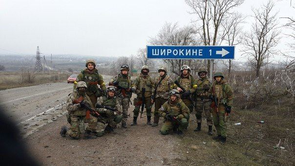
War in Donbass
The village became a battleground in 2014–15 during a war between separatists affiliated with the Donetsk People's Republic and the Ukrainian government.
Prior to the war, the village was situated in Novoazovsk Raion. This was changed on 9 December 2014, when the Ukrainian parliament voted to change the boundaries of the Raion, so as to allow Ukrainian-controlled territories to be separated from DPR-controlled territories. The village and its neighbours were thus placed into an expanded Volnovakha Raion.
All civilians were evacuated from the village in February 2015, with up to 80% of the village's houses damaged beyond repair by July of that year.
By the end of February 2016 Ukrainian troops took the village under their control as pro-Russian forces withdrew from the settlement.