
Population 16,775 (2011 Census) Sovereign state United Kingdom Local time Sunday 7:56 AM | OS grid reference SJ305685 Country Wales Postcode district CH5 Dialling code 01244 Post town Deeside | |
 | ||
Weather 8°C, Wind NW at 18 km/h, 87% Humidity | ||
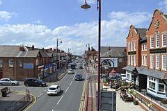
Shotton is a town in Flintshire, Wales, lying within the Deeside conurbation along the River Dee, adjoining Connah's Quay, near the border with England. It is located 5 miles (8 km) west of Chester and can be reached by road from the A548. The name probably derives from Anglo-Saxon Scēot-tūn = "farmstead on or near a steep slope". At the 2011 Census Shotton had a population of 16,775.
Contents
Map of Shotton, Deeside, UK
History
Founded by Anglo-Saxons, the town grew from the eighteenth century around coal mining and farming on reclaimed marshland. , and Shotton also became a railway junction.
The town lies under the Hawarden Bridge, which was completed in 1889 as a swing-opening bridge.
Education
Shotton is served by the following schools:
Media
Deeside is served by a citizen led hyperlocal news website deeside.com which is a collaborative community resource set up 2013.
Transportation
Transport links include Shotton railway station, situated on the Borderlands Line and the North Wales Coast Line.