
Population 9,230 (1992) Area 2,277 km² | Established 1869 Shire of Rosedale Bass Strait Founded 1869 | |
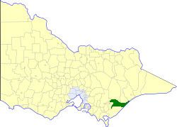 | ||
The Shire of Rosedale was a local government area stretching between the towns of Traralgon and Sale in the Gippsland region of Victoria, Australia. The shire covered an area of 2,276.6 square kilometres (879.0 sq mi), and existed from 1869 until 1994.
Contents
History
Rosedale was incorporated as a road district on 26 February 1869, and became a shire on 17 February 1871. It annexed part of the Shire of Alberton on 20 May 1914.
On 2 December 1994, the Shire of Rosedale was abolished, and, along with the City of Sale, and parts of the Shires of Alberton and Avon, was merged into the newly created Shire of Wellington. The Boole Poole Peninsula south of Metung was transferred to the newly created Shire of East Gippsland, while the Glengarry and Toongabbie districts north of Traralgon were transferred to the newly created City of Latrobe.
Wards
The Shire of Rosedale was divided into three ridings, each of which elected three councillors:
Towns and localities
Population
* Estimate in the 1958 Victorian Year Book.