
Population 930 (2006 census) Local time Monday 6:07 AM | Postcode(s) 3851 Postal code 3851 | |
 | ||
Weather 15°C, Wind W at 6 km/h, 80% Humidity Points of interest Sale Swing Bridge, Holey Plains State Park, Sale Common Nature Conservation Reserve, Holey Hill | ||
Longford is a town in the Gippsland region of Victoria, Australia. At the 2006 census, Longford and the surrounding area had a population of 929.
Map of Longford VIC 3851, Australia
It was named after the town and county of Longford in Ireland.
It is located at the junction of the South Gippsland Highway and the Longford-Rosedale Road, next to the Latrobe River. A new bridge over the floodprone Latrobe River was completed in 2006, replacing the historic swinging bridge. The road approach to the Sale Swing Bridge was prone to flooding, cutting the road to Sale, Victoria.
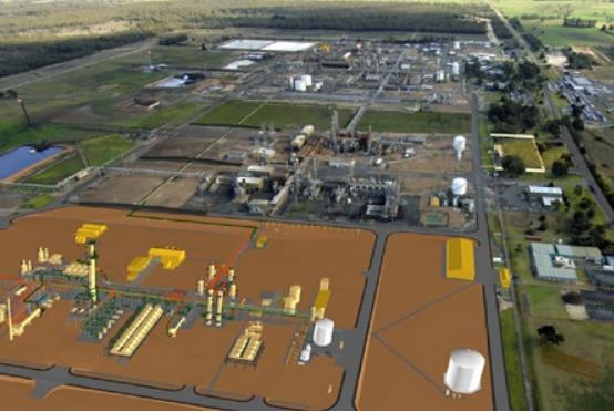
In September 1998, a large explosion at an Esso operated oil and natural gas processing plant was responsible for an almost complete shutdown of Victoria's natural gas supply for weeks thereafter. At 12:25pm 25 September 1998 the weld on GP905 cracked and the exchanger failed catastrophically instantly killing two people. A Royal Commission subsequently found that Esso breached health and safety rules, and was responsible for the explosion.
Golfers play at the course of the Sale Golf Club on Longford-Rosedale Road.