
Population 5,330 (1992) Area 101 km² | Established 1928 Founded 1928 | |
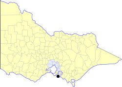 | ||
The Shire of Phillip Island was a local government area in Western Port about 120 kilometres (75 mi) south of Melbourne, the state capital of Victoria, Australia. The shire covered an area of 101.05 square kilometres (39.0 sq mi), and existed from 1928 until 1994.
Contents
History
Phillip Island was initially incorporated as part of the Phillip Island Road District on 8 September 1871, which was, however, based on the mainland. This district became the Shire of Phillip Island and Woolamai on 24 December 1874. A severance movement was successful in creating a separate Shire of Phillip Island on 18 September 1928, with the remainder ultimately becoming the Shire of Bass.
On 2 December 1994, the Shire of Phillip Island was abolished, and, along with the Borough of Wonthaggi and the Shire of Bass and parts of the City of Cranbourne and the Shires of Korumburra and Woorayl, was merged into the newly created Bass Coast Shire.
The Shire of Phillip Island had 9 councillors, each of whom represented the entire shire.
Towns and localities
Population
* Estimate in the 1958 Victorian Year Book.