
Population 12,030 (1992) Area 1,246 km² Council seat Leongatha | Established 1888 Founded 1888 | |
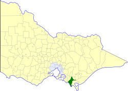 | ||
The Shire of Woorayl was a local government area about 130 kilometres (81 mi) southeast of Melbourne, the state capital of Victoria, Australia. The shire covered an area of 1,245.79 square kilometres (481.0 sq mi), and existed from 1888 until 1994.
Contents
History
Initially part of the Shire of Narracan, Woorayl was first incorporated as a shire on 25 May 1888. It annexed the South riding of the Shire of Alberton on 14 March 1890, and the Mirboo riding of the Shire of Traralgon on 1 May 1891. Over the next 20 years, various boundary changes occurred between Woorayl, Korumburra, Narracan and South Gippsland
On 2 December 1994, the Shire was abolished, and merged with Shire of Mirboo, Shire of South Gippsland and most of Shire of Korumburra into the South Gippsland Shire. The area around Inverloch was moved into the new Bass Coast Shire
Wards
Woorayl was divided into four ridings in May 1975, each of which elected three councillors:
Towns and localities
Population
* Estimate in the 1958 Victorian Year Book.