
President Norm Trenfield Area 100,789 km² | State electorate(s) North West Population 1,796 (2001) | |
 | ||
Shire of meekatharra
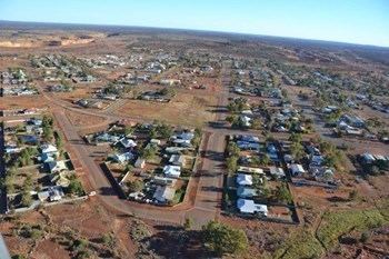
The Shire of Meekatharra is a local government area in the Mid West region of Western Australia, about halfway between the town of Port Hedland and the state capital, Perth, Western Australia. The Shire covers an area of 100,789 square kilometres (38,915 sq mi), and its seat of government is the town of Meekatharra.
Contents
Map of Meekatharra, WA 6642, Australia
History
The Meekatharra Road District was gazetted in 1909, and became a shire on 1 July 1961 under the Local Government Act 1960.
Wards
The shire is divided into three wards:
Towns and localities
References
Shire of Meekatharra Wikipedia(Text) CC BY-SA