
Population 925 (2010) State electorate(s) Mount Isa Founded 1879 | Established 1879 Website Shire of Etheridge Area 39,332 km² Mayor Warren Devlin | |
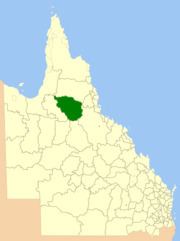 | ||
The Shire of Etheridge is a local government area in Far North Queensland, Australia in what is known as the Savannah Gulf region. Its economy is based on cattle grazing and mining.
Contents
- Map of Etheridge QLD Australia
- History
- Towns and localities
- Former towns and localities
- Chairmen
- References
Map of Etheridge, QLD, Australia
It covers an area of 39,332.3 square kilometres (15,186.3 sq mi), and has existed as a local government entity since 1882.
History
The Einasleigh Division was created on 11 November 1879 as one of 74 divisions around Queensland under the Divisional Boards Act 1879 with a population of 720. In 1891 it was reported that the divisional board had made no progress, perhaps because it covered a large area that was sparsely settled.
With the passage of the Local Authorities Act 1902, Einasleigh Division became the Shire of Einasleigh on 31 March 1903.
On 15 March 1919, it was renamed Shire of Etheridge.
Towns and localities
The Shire of Etheridge includes the following settlements:
Former towns and localities
The Etheridge Shire had many mines in the late 1800s. This gave rise to a number of communities that no longer exist today: