
Population 2,149 (2010) Founded 1883 | Established 1883 Website Shire of Carpentaria Area 64,373 km² Mayor Fred Pascoe | |
 | ||
The Shire of Carpentaria is a local government area in Far North Queensland, Australia on the Gulf of Carpentaria, for which it is named.
Contents
Map of Carpentaria, QLD, Australia
It covers an area of 64,372.7 square kilometres (24,854.4 sq mi), and has existed as a local government entity since 1883. Its two main population centres are the towns of Karumba, a fishing port, and Normanton, the administrative centre, both of which are located on the Norman River.
History
The Doonmunya Division was created on 11 November 1879 as one of 74 divisions around Queensland under the Divisional Boards Act 1879 with a population of 396. However, the divisional board appeared to be completely inactive, perhaps because the division was so large (being the area surrounding the southern part of the Gulf of Carpentaria) and was very sparsely settled. Nonetheless some of the citizens were unhappy about this. Consequently, on 11 January 1883, the Doonmunya Division was abolished and a new Carpentaria Division was created to replace it.
Given the size of the Carpentaria Division, the distance to its headquarters in Normanton was an issue for residents in the Cloncurry area, leading to a desire to create their own local division. On 7 February 1884, part of Carpentaria Division was separated to create the new Cloncurry Division.
However, once the Carpentaria Divisional Board became operational, the residents of the Burketown area became concerned that their rates were likely to be spent on the Normanton area rather than their own and began to agitate for their own division west of the Leichhardt River. On 30 January 1885, the Burke Division was created from lands formerly within the Carpentaria Division with some adjustments to the Cloncurry Division.
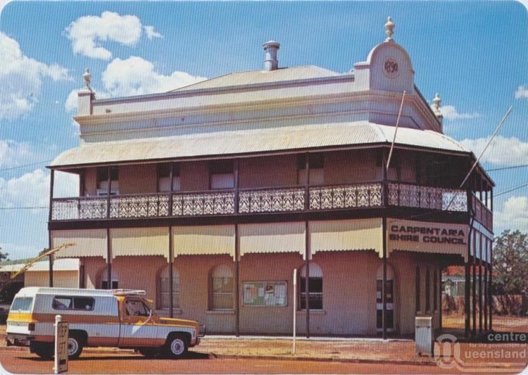
With the passage of the Local Authorities Act 1902, Carpentaria Division became the Shire of Carpentaria on 31 March 1903.
Prior to 2005, two Aboriginal communities (Kowanyama and Pormpuraaw) administered under Deed of Grant in Trust by community councils since the mid-1980s, were part of the Shire's area, but they were formally excised and given a new status as Aboriginal Shires.
Towns and localities
The Shire of Carpentaria includes the following settlements:
Chairmen and mayors
Population
Prior to 1971, Aboriginal people who form a majority of the population were not counted in census statistics.
Until 1 July 2002, the Australian Bureau of Statistics included the Island and DOGIT councils within the Shire of Cook statistical local area. Information for the reduced Shire back to 1996 has been provided on the ABS website through the Time Series Profile.