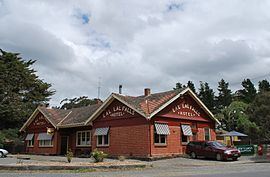
Population 599 (2011 census) Lal Lal Bungal Local time Sunday 8:48 AM | Postcode(s) 3352 State electorate(s) Buninyong Postal code 3352 | |
 | ||
Weather 16°C, Wind NE at 14 km/h, 94% Humidity | ||
400 lal lal falls road lal lal victoria 3352
Lal Lal is a town in Victoria (Australia), Australia. The town is located in the Shire of Moorabool and on the Geelong-Ballarat railway line, 108 kilometres (67 mi) west of the state capital, Melbourne. At the 2011 census, Lal Lal and the surrounding area had a population of 599.
Contents
- 400 lal lal falls road lal lal victoria 3352
- Map of Lal Lal VIC 3352 Australia
- History
- Heritage listed sites
- References
Map of Lal Lal VIC 3352, Australia
Lal Lal Falls and the Lal Lal Reservoir on the Moorabool River are to the north of the town.
History
The original settlement at Lal Lal was part of a substantial sheep run dating from 1845. The township became more firmly established after the mining of iron ore, lignite, kaolin (clay) and gold began in the area.
The railway arrived at Lal Lal in April 1862 and Lal Lal Post Office opened on 18 July 1863 (closing in 1969).
Heritage listed sites
Lal Lal contains a number of heritage listed sites, including:
