
River mouth 4,383 feet (1,336 m) | Length 105 km | |
 | ||
Shields river valley ranch livingston montana sold
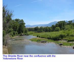
The Shields River is a tributary of the Yellowstone River, 65.4 miles (105.3 km) long, in Meagher and Park Counties Montana in the United States.
Contents
Map of Shields River, Montana, USA
It rises in the Gallatin National Forest in the Crazy Mountains in northern Park County. It flows west, then south, between the Bridger Range to the west and the Crazy Mountains to the east, past Wilsall and Clyde Park. It joins the Yellowstone approximately 10 mi (16 km) northeast of Livingston. The Shields River was named for John Shields (explorer), a member of the Lewis and Clark Expedition.
The river hosts native Yellowstone cutthroat trout and Mountain whitefish as well as introduced brown and rainbow trout.
References
Shields River Wikipedia(Text) CC BY-SA