
Area 7,286 km² Population 15,682 (2013) | Congressional district At-large Website www.parkcounty.org Founded 1887 Unemployment rate 5.2% (Apr 2015) | |
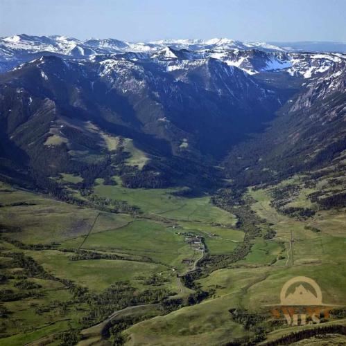 | ||
Points of interest Yellowstone River, Yellowstone National Park, Roosevelt Arch, Fort Yellowstone, Boiling River | ||
Park County is a county located in the U.S. state of Montana. At the 2010 census, the population was 15,636. Its county seat is Livingston. A small part of Yellowstone National Park is located in the extreme southern part of the county.
Contents
- Map of Park County MT USA
- Geography
- Major highways
- Adjacent counties
- National protected areas
- History
- 2000 census
- 2010 census
- City
- Town
- Other unincorporated community
- Ghost town
- References
Map of Park County, MT, USA
Geography
According to the U.S. Census Bureau, the county has a total area of 2,813 square miles (7,290 km2), of which 2,803 square miles (7,260 km2) is land and 10.4 square miles (27 km2) (0.4%) is water. The highest natural point in Montana, Granite Peak at 12,807 feet (3,904 m), is located in Park County. The county attained its present boundaries in 1978, when the former Yellowstone National Park (part) county-equivalent was dissolved and apportioned between Gallatin County and Park County. Gallatin County received 99.155 square miles (256.81 km2) of land area and 0.119 square miles (0.31 km2) of water area, whereas Park County received 146.229 square miles (378.73 km2) of land area and 0.608 square miles (1.57 km2) of water area. The geographies transferred are known now as Census Tract 14 in Gallatin County, and as Census Tract 6 in Park County.
Major highways
Adjacent counties
Park County in Montana and Park County in Wyoming are two of twenty-two counties or parishes in the United States with the same name to border each other across state lines. The others are Big Horn County, Montana and Big Horn County, Wyoming; Bristol County, Massachusetts and Bristol County, Rhode Island; Escambia County, Alabama and Escambia County, Florida; Kent County, Delaware and Kent County, Maryland; Pike County, Illinois and Pike County, Missouri; Sabine County, Texas and Sabine Parish, Louisiana; San Juan County, New Mexico and San Juan County, Utah; Teton County, Idaho and Teton County, Wyoming; Union Parish, Louisiana and Union County, Arkansas; and Vermilion County, Illinois and Vermillion County, Indiana (both these counties are named for the Vermilion River, despite their different spellings).
National protected areas
History
Park County, so named due to its proximity to Yellowstone National Park, was created by the territorial legislature February 23, 1887. Scout Jim Bridger wintered in the area in 1844-45.
2000 census
At the 2000 census, there were 15,694 people, 6,828 households and 4,219 families residing in the county. The population density was 6 per square mile (2/km²). There were 8,247 housing units at an average density of 3 per square mile (1/km²). The racial makeup of the county was 96.65% White, 0.40% Black or African American, 0.92% Native American, 0.36% Asian, 0.03% Pacific Islander, 0.47% from other races, and 1.17% from two or more races. 1.84% of the population were Hispanic or Latino of any race. 23.5% were of German, 12.4% English, 9.5% Norwegian, 9.0% Irish and 7.9% American ancestry.
There were 6,828 households of which 28.10% had children under the age of 18 living with them, 51.00% were married couples living together, 7.30% had a female householder with no husband present, and 38.20% were non-families. 32.40% of all households were made up of individuals and 11.70% had someone living alone who was 65 years of age or older. The average household size was 2.27 and the average family size was 2.88.
23.50% of the population were under the age of 18, 6.50% from 18 to 24, 27.90% from 25 to 44, 27.10% from 45 to 64, and 14.90% who were 65 years of age or older. The median age was 41 years. For every 100 females there were 97.40 males. For every 100 females age 18 and over, there were 96.10 males.
The median household income was $31,739 and the median family income was $40,561. Males had a median income of $28,215 and females $19,973. The per capita income was $17,704. About 7.20% of families and 11.40% of the population were below the poverty line, including 13.10% of those under age 18 and 10.10% of those age 65 or over.
2010 census
As of the 2010 United States Census, there were 15,636 people, 7,310 households, and 4,177 families residing in the county. The population density was 5.6 inhabitants per square mile (2.2/km2). There were 9,375 housing units at an average density of 3.3 per square mile (1.3/km2). The racial makeup of the county was 96.5% white, 0.8% American Indian, 0.3% Asian, 0.1% black or African American, 0.5% from other races, and 1.6% from two or more races. Those of Hispanic or Latino origin made up 2.1% of the population. In terms of ancestry, 26.2% were German, 17.3% were English, 16.2% were Irish, 10.9% were Norwegian, and 7.4% were American.
Of the 7,310 households, 23.5% had children under the age of 18 living with them, 46.7% were married couples living together, 7.0% had a female householder with no husband present, 42.9% were non-families, and 35.7% of all households were made up of individuals. The average household size was 2.12 and the average family size was 2.75. The median age was 45.4 years.
The median income for a household in the county was $38,830 and the median income for a family was $50,252. Males had a median income of $36,878 versus $31,062 for females. The per capita income for the county was $24,717. About 7.7% of families and 13.6% of the population were below the poverty line, including 19.3% of those under age 18 and 10.7% of those age 65 or over.