
Postal index 30410—30457 | Established 1923 Time zone EET (UTC+2) Area 1,160 km² | |
 | ||
Subdivisions List 0 — city councils 1 — settlement councils22 — rural councilsNumber of localities: 0 — cities 1 — urban-type settlements68 — villages 0 — rural settlements | ||
Shepetivka Raion (Ukrainian: Шепетівський район) is a raion in Khmelnytskyi Oblast in Ukraine. Its administrative center is Shepetivka. Its population is 35 253 inhabitants (January 1, 2011).
Contents
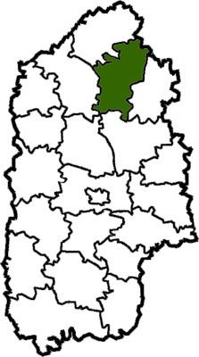
Map of Shepetivs'kyi district, Khmelnytska, Ukraine
It was established in 1923. 1 city (Shepetivka — city of regional significance), 1 urban-type settlement (Hrytsiv) and 68 villages are located in Shepetivka Raion.
Geography
Shepetivka Region is a part of Volhynia. It is one out 20 Raions of Khmelnytskyi Oblast. It is a large Raion and ranks as the 8th among the largest with respect to the total area (1 160 km² corresponding to 5.6% of the total area of Khmelnytskyi Oblast).
Shepetivka Raion is southeast of Slavuta Raion, southwest of Zhytomyr Oblast (Baranivka Raion), west of Polonne Raion, north of Starokostiantyniv Raion, and east of Iziaslav Raion. The Homora, Korchyk, Tsvitoha, Smilka and other rivers flow through the district. There is a rail lines through the districts (Shepetivka—Slavuta—Zdolbuniv), Shepetivka—Iziaslav—Ternopil, Shepetivka—Starokostiantyniv, Shepetivka—Polonne and Shepetivka—Novohrad-Volynskyi.
History
From 1923 to 1932, the district was part of the Shepetivka region, then from 1932 to 1937 it was part of the Vinnytsia region. Following that from 1937 to 1954 it was part of the Kamenets Podolsk region. Since 1954 it has been part of the Khmelnytskyi region.