
 | ||
Sheerness Dockyard was a Royal Navy Dockyard located on the Sheerness peninsula, at the mouth of the River Medway in Kent. It was opened in the 1660s and closed in 1960.
Contents
Location
In the Age of Sail, the Royal Navy would often establish shore facilities close to safe anchorages where the fleet would be based in home waters. This was the case when, around 1567, a Royal Dockyard was established at Chatham, Kent, on the bank of the River Medway. At that time, HM Ships would often lay at anchor either within the river, on Chatham Reach or Gillingham Reach, or beyond it, around The Nore.
Chatham Dockyard had its disadvantages, however. The vagaries of wind and tide, coupled with the restricted depth of the river, meant that vessels entering the river, for repairs or to replenish supplies at Chatham, could be delayed for considerable lengths of time. What was an inconvenience at times of peace became a serious impediment at times of war; and for this reason, warships based in the Nore would tend if possible to avoid entering the river, and would try to do all but the most serious repairs while afloat and at anchor. At the same time, those who were responsible for supplying warships with their weapons, victuals and equipment were obliged to ferry items to and from The Nore using small boats.
In order to operate more effectively, the Navy Board began to explore options for developing a new dockyard at the mouth of the Medway, able to be accessed by ships directly from the North Sea and Thames Estuary. Possible locations were explored on both the Isle of Grain and the Isle of Sheppey; the Board decided on a location at the north-west tip of Sheppey alongside a 16th-century blockhouse (built to supplement the Henrician defences of the Thames): Sheerness.
Origins
In 1665 Samuel Pepys, who was Clerk of the Acts of the Navy Board, recorded visiting Sheerness to measure out the site for the new dockyard. The situation was overtaken, however, by the escalating Anglo-Dutch conflict: in order to make the ships in The Nore battle-ready, temporary buildings were hastily erected. Work continued, but in 1667 the still-incomplete dockyard was easily captured, together with the adjacent fort, by the Dutch Navy and used as the base for a daring but humiliating raid on the English ships at anchor in the Medway. Both fort and dockyard were left in flames, along with a significant number of the ships moored in the river.
Early fortification
In 1666 Sir Bernard de Gomme had been engaged to strengthen the blockhouse on the northern tip of the promontory. After the Dutch raid the following year, an expanded fort was planned. The blockhouse (which became the Governor's residence) was strengthened, and encircled by a semi-circular gun battery to the north, while to the south a line of fortification was constructed, which cut off the northernmost part of Sheerness behind a flooded ditch. The garrisoned fort, enclosed by walls to the west and east, took up most of this fortified area, leaving the dockyard to occupy the remaining small parcel of land north of the ditch, on the Medway side of the fort (outside its western wall). A gateway through this wall, accessed from the dockyard, provided the main entrance to the fort; the gatehouse was a prominent feature and contained a chapel on its first floor.
Eighteenth-century developments
Sheerness Dockyard initially functioned as an extension to that at Chatham and it was overseen by Chatham's resident Commissioner for much of its early history. It was conceived primarily for the repair and maintenance of naval ships; with one small exception, no shipbuilding took place until 1691. Low quality housing, the poor water supply near the dockyard and a likelihood of contracting ague from the surrounding marshland all led to a lack of workers and caused construction delays. The first dry-dock was not completed until 1708; a second was added in 1720. Access to the two dry docks was by way of a tidal basin, tellingly known as the Mud Dock; there was a small shipbuilding slip to its north and an ordnance wharf to the south, with timber stores and a mast pond beyond.
The constricted area of land available to the dockyard caused problems for its operation and development. Several hulks were positioned on the foreshore close to the dockyard, initially to serve as breakwaters, but soon they served to accommodate both personnel and dockyard activities. The space between the hulks (and, as they began to rot, the hulks themselves) were progressively infilled with soil, with new hulks then being added as part of the process. In this way, the land occupied by the dockyard began to expand (as is clearly seen in a surviving model of the dockyard, created in 1774 and now in the National Maritime Museum) By this time two more dry docks had been added, and over the next ten years living conditions were substantially improved by the sinking of a well to provide drinking water (which had previously had to be ferried in).
Workers' housing and further fortification
There was no established settlement in the vicinity of Sheerness, so most of the workers were initially housed in the hulks. By 1738, dockyard construction workers had built the first houses in Sheerness, using materials they were allowed to take from the yard. The grey-blue naval paint they used on the exteriors led to their homes becoming known as the Blue Houses. This was eventually corrupted to Blue Town (which is now the name of the north-west area of Sheerness lying just beyond the current dockyard perimeter). The modern town of Sheerness has its origins in Mile Town, which was established later in the 18th century at a mile's distance from the dockyard (Blue Town having by then filled the space available).
In 1796, following the development of Blue Town, a wider area of land (including the new houses) was enclosed behind a bastioned trace, which was further strengthened during the Napoleonic Wars of the following century.
The rebuilding
Following the Napoleonic Wars, an opportunity was taken to rebuild the Dockyard. The site was leveled in 1815, and over the next 15 years the new Dockyard was laid out, according to meticulous plans drawn up by John Rennie. A full-scale model created at the time, which still exists, shows how much of the original remains. The principal architects were Edward Holl and his successor George Taylor who was already an established architect with a practice in London and had been responsible for some of London's most fashionable squares. In all the project cost £2,586,083 and was completed by 1830, providing fine terraced houses for naval officers. Sheerness was unusual among Dockyards in the unity and clarity of its design, having been built in one phase of construction, of a single architectural style according to a unified plan (rather than developing piecemeal over time).
In the early 1820s a fire destroyed many buildings at the dockyard, including all the Blue Houses. New houses and a major redevelopment of the dockyard followed. On 5 September 1823, the rebuilt dockyard was formally opened by the Duke of Clarence (later William IV). A high brick wall and a moat were constructed around the yard to serve as a defence measure and remained in place until the end of the 19th century. As the settlement expanded eastwards, away from the dockyard and the Blue Houses, the wider area became known as Sheerness, taking its new name from the brightness or clearness of the water at the mouth of the River Medway. Completed in 1860 and still standing today, the Sheerness Boat Store was the world's first multi-storey building with a rigid metal frame.
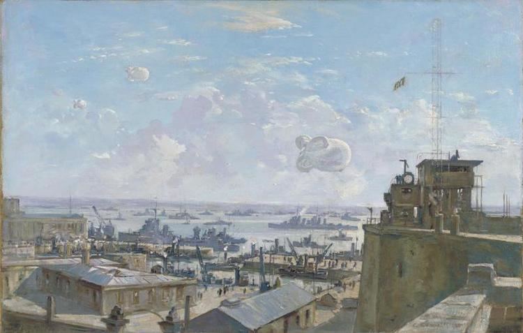
From the completion of the dockyard until 1960 Sheerness was one of the bases of the Nore Command of the Royal Navy, which was responsible for protecting British waters in the North Sea. The command was named after the Nore sandbank in the Thames Estuary, about 3 miles (5 km) east of Sheerness. In 1797, discontented sailors in the Royal Navy mutinied just off the coast of Sheerness.
In March 1960 the Royal Navy ceased operating the Sheerness dockyard and the Medway Port Authority took over the site for commercial use. The dockyard closure led to thousands of job losses, and most of the nearby houses and shops in the Bluetown area were eventually abandoned and demolished.