
Elevation 0 cm | ||
 | ||
Similar River Thames, Maunsell Forts, London Array, Redsand Fort, Thames Barrier | ||
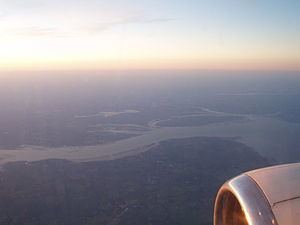
The Thames Estuary is the estuary in which the River Thames meets the waters of the North Sea, in the south-east of Great Britain.
Contents
Map of Thames Estuary, United Kingdom
It is not easy to define the limits of the estuary. Although physically the head of Sea Reach or the Kent / Essex Strait, south of Canvey Island on the northern (Essex) shore presents a western boundary, the Tideway itself can be considered estuarine; it starts in south-west London at Teddington/Ham. The eastern boundary of the estuary suggested in a Hydrological Survey of 1882-9 is a line drawn from North Foreland, Margate, Kent via the Kentish Knock lighthouse to Harwich in Essex. It is to this line that the typical estuarine sandbanks extend. The estuary downstream of the Tideway has a tidal movement of 4 metres, moving at a speed of 8 miles per hour.
The estuary is one of the largest of 170 such inlets on the coast of Great Britain. It constitutes a major shipping route: its thousands of movements each year include large oil tankers, container ships, bulk carriers and roll-on/roll-off (ro-ro) ferries entering the estuary for the Port of London and the Medway Ports of Sheerness, Chatham and Thamesport.
The traditional Thames sailing barge worked in this area, designed to be suitable for the shallow waters in the smaller ports. More recently one of the largest wind farms in the UK has been developed in the estuary, located 8.5 km north of Herne Bay, Kent. The farm contains 30 wind turbines generating a total of 82.4MW of electricity. The much larger London Array of up to 1GW capacity is also planned.
This area has had several proposed sites for the building of a new airport to supplement, or even to replace Heathrow/Gatwick. In the 1960s Maplin Sands was a contender; in 2002 it was to be at Cliffe, Kent. The new airport would be built on a man-made island in the estuary north of Minster-in-Sheppey There is also some discussion about the need for a Lower Thames Crossing in order to alleviate traffic congestion at Dartford.
The Thames Estuary is the focal part of the 21st-century toponym, the "Thames Gateway", designated as one of the principal development areas in Southern England.
Greater Thames EstuaryEdit
The appellation Greater Thames Estuary applies to the coast and the low-lying lands bordering the estuary itself. These are characterised by the presence of mudflats, low-lying open beaches and salt marshes, namely the North Kent Marshes and the Essex Marshes. Man-made embankments are backed by reclaimed wetland grazing areas, but Rising sea levels may make it necessary to temporarily flood some of that land in places at spring tides, to take the pressure off the defences.
There are many smaller estuaries in Essex, including the Rivers Colne, Blackwater and Crouch Small coastal villages depend on an economy of fishing, boat-building, and yachting. The Isle of Sheppey, Foulness Island and Mersea Island are part of the coastline
Where higher land reaches the coast there are some larger settlements, such as Clacton-on-Sea to the north in Essex, Herne Bay, Kent, and the Southend-on-Sea area within the narrower part of the estuary
SalinityEdit
The River Thames flowing through London is a classic river estuary, with sedimentary deposition restricted through manmade embankments. The district of Teddington a few miles south-west of London's centre marks the boundary between the tidal and non-tidal parts of the Thames, although it is still considered a freshwater river about as far east as Battersea insofar as the average salinity is very low and the fish fauna consists predominantly of freshwater species such as roach, dace, carp, perch, and pike. The Thames Estuary becomes brackish between Battersea and Gravesend, and the diversity of freshwater fish species present is smaller, primarily roach and dace, euryhaline marine species such as flounder, European seabass, mullet, and smelt become much more common. Further east, the salinity increases and the freshwater fish species are completely replaced by euryhaline marine ones, until the river reaches Gravesend, at which point conditions become fully marine and the fish fauna resembles that of the adjacent North Sea and includes both euryhaline and stenohaline marine species. A similar pattern of replacement can be observed with the aquatic plants and invertebrates living in the river.