
Area 64.14 km² Local time Monday 12:04 AM | Region Kantō Phone number 0278-24-5111 Population 7,229 (Feb 2015) | |
 | ||
Address 388 Ōaza Itoi, Shōwa-mura, Tone-gun, Gunma-ken 379-1298 Weather -1°C, Wind N at 6 km/h, 86% Humidity | ||
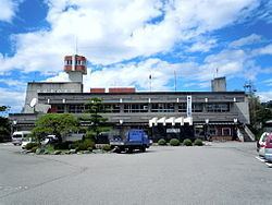
Shōwa (昭和村, Shōwa-mura) is a village located in Tone District of central Gunma Prefecture in the northern Kantō region of Japan. As of February 2015, the village had an estimated population of 7,229 and a population density of 113 persons per km2. Its total area was 64.14 km2.
Contents
- Map of Showa Tone District Gunma Prefecture Japan
- Geography
- Surrounding municipalities
- History
- Economy
- Education
- Transportation
- Highways
- References
Map of Showa, Tone District, Gunma Prefecture, Japan
Geography
Located in central Gunma, Shōwa is on the northwestern slopes of Mt. Akagi, it is surrounded on the north, east, and west by the city of Numata and borders Shibukawa to the south
Surrounding municipalities
History
The area of present-day Shōwa was part of the tenryō holdings in Kōzuke Province administered directly by the Tokugawa shogunate during the Edo period. On April 1, 1889 with the creation of the municipalities system after the Meiji Restoration, Kuroho and Itonose villages were established within Kitaseta District, Gunma. In 1896, Kitaseta District and a portion of Agatsuma DIstrict were transferred to Tone District, The two villages merged on November 1, 1958 to form Shōwa.
Economy
Traditionally, the economy of Shōwa was heavily dependent on agriculture; primarily market gardening.
Education
Transportation
Shōwa is not served by any railway services. The nearest station is Numata in the neighboring city of Numata.