
Incorporated 1871 Time zone EET (UTC+2) Area 2,207 km² Area code 332 | Region Mediterranean Elevation 1,089 m (3,573 ft) Postal code 42360-42370 Local time Thursday 11:58 PM | |
 | ||
Weather 8°C, Wind S at 3 km/h, 82% Humidity | ||
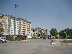
Seydişehir is a town and district of Konya Province in the Central Anatolia region of Turkey. According to 2000 census, population of the district is 85,456 of which 48,372 live in the town of Seydişehir.
Contents
- Map of SeydiC59Fehir Konya Turkey
- Seydi ehir in tan t m belgeseli
- History
- Other
- Geography
- Prominent Persons
- References
Map of Seydi%C5%9Fehir, Konya, Turkey
Seydi ehir in tan t m belgeseli
History
Seydişehir is based on a very old history. In 5500 BC, Seydişehir was in Psidia's border and had a lot of historical building. City has a valley between Trogitis Lacos and Karalis Lacos. We can see pre-historic buildings in valley. A they are still in Konya Archeology Museum. In 2000–700 BC, Hittite that's conqueror of middle Anatolia, built symbols and handiwork. It is obvious in Seydişehir that rock reliefs that was made by Hittite, is the proof of Hittite's living area.
Other
Seydişehir is famous with roasted chickpeas in Turkey. It called "Seydisehir chickpeas" and People who lives in Seydişehir, grows roasted chickpeas. The plant grows to between 20–50 cm (8–20 inches) high and has small feathery leaves on either side of the stem.
Geography
Seydişehir is in the south of Konya city center, is in the north of The Taurus Mountains and in the plain Suğla that's efficient valley.