
Length 210 mi (338 km) Season All year | ||
 | ||
Highest point Plynlimon, 752 m (2,467 ft) | ||
The severn way walk in 7 days
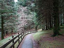
The Severn Way is a waymarked long-distance footpath in the United Kingdom, which follows the course of the River Severn through Mid Wales and western England.
Contents
- The severn way walk in 7 days
- Diglis basin severn way worcester worcestershire england 31st july 2011
- Distance
- The route
- Connecting trails
- References
Diglis basin severn way worcester worcestershire england 31st july 2011
Distance
The Long Distance Walkers Association gives the Severn Way's length as 360.3 km (223.9 mi).
The route
The source of the River Severn is high on Plynlimon, in the uplands of Mid-Wales, from where both river and walk descend to Llanidloes, Newtown, Powys and Welshpool. It then follows the towpath of the Montgomeryshire Canal, passing through Shrewsbury, Shropshire and the Severn Gorge. It passes the cradle of the Industrial Revolution at Ironbridge before passing through Bridgnorth, Hampton Loade and Highley (in Shropshire), and Bewdley in Worcestershire, Stourport-on-Severn, Worcester, Upton-upon-Severn and Tewkesbury. It enters Gloucestershire and passes through Gloucester itself before passing Berkeley Castle and following the Severn Estuary past Slimbridge. Originally the path finished at Severn Beach, but it has recently been extended to Bristol via Lawrence Weston, Shirehampton and through the Avon Gorge.
Connecting trails
The Way links with the Gloucestershire Way, Wye Valley Walk, Worcestershire Way, Staffordshire and Worcestershire Canal Walk, Worcester & Birmingham Canal Walk, Three Choirs Way and Telford and Wrekin Walks, and Shakespeare's Avon Way.