
 | ||
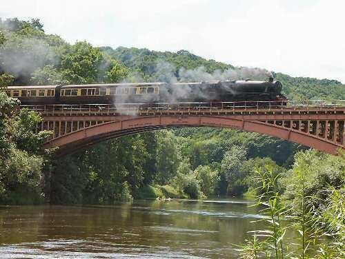
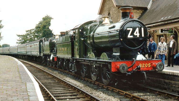
Severn valley railway spring steam gala 2017
The Severn Valley is a rural area of mid-western England, through which the River Severn runs and the Severn Valley Railway steam heritage line operates, starting at its northernmost point in Bridgnorth, Shropshire and running south for 16 miles (26 km) to Ribbesford, a few miles south of Bewdley, Worcestershire in the Wyre Forest.
Contents
- Severn valley railway spring steam gala 2017
- Severn valley railway season finale gala 2016
- History
- Geology and roads
- Towns and villages
- Features
- In fiction
- References
The area is about 25 miles (40 km) due west of Birmingham in the West Midlands region.
There is also use of this term to apply to areas around the River Severn as far south as Gloucester, and as far north as Ironbridge. To the north of Bridgnorth, the area around the river becomes much steeper and is known as Ironbridge Gorge. From Stourport on Severn south to Gloucester, the riverside has a much larger flood plain and loses its distinctive "valley" hillsides found a few miles north in Bewdley. To the south of Gloucester, it becomes the Vale of Berkeley and then the Severn Estuary.
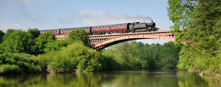
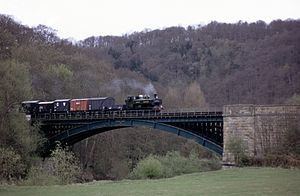
Severn valley railway season finale gala 2016
History
The Severn Valley was under the rule of Ceawlin of Wessex after the Battle of Deorham in 577 AD as part of The Kingdom of Hwicce. In 628 AD, Penda of Mercia's victory in the Battle of Cirencester led to his rule over the Severn Valley.
Geology and roads
The area is typified by a substantial river bed with deep fast-flowing channels, surrounded by a small flood plain and rolling wooded hills. Due to the soft sandstone banks, it is difficult to build bridges that can bear heavy loads. The only public road bridges are at Bridgnorth and Bewdley, meaning that there is no way for road traffic to cross the river for 16 miles(26 km). The two main roads along the valley are the A442 on the east side from Bridgnorth via Alveley to Kidderminster and the B4555 on the west from Bridgnorth via Highley to Bewdley. Both of these run north-south roughly parallel with the river.
Towns and villages
Starting north at Bridgnorth and running south downstream, the area encompasses the following locations:
Some definitions continue through Worcestershire and into Gloucestershire as far south as Gloucester.
Features
There are riverside footpaths throughout almost the entire length of the Severn Valley on both sides, including the Severn Way long distance footpath, making it a popular haunt for anglers and ramblers, often combining a leisurely walk with a return trip on the Severn Valley Railway. A number of traditional pubs cater for the tourist trade.
At the centre of the area, between Highley and Alveley, is the Severn Valley Country Park, with level-access and wide flat footpaths for wheelchair users, plus conveniences and a small visitors' centre.
During periods of low water (typically August), fording the river is occasionally possible at almost any point along the Severn Valley, notably near the old bridges at Bridgnorth and Bewdley, and at the appropriately named Quatford. At mid and high water, fording is dangerous due to deep, fast-flowing and often non-visible river channels. Forders are advised to test depth with a long stick as they progress.
In fiction
The term Severn Valley is also used to refer to a fictional location in horror novels based on the works of H. P. Lovecraft. However, this fictional location is based on the Gloucestershire, Vale of Berkeley and Cotswolds regions, some 60 miles (100 km) further south of the real-life Severn Valley.
Characters in the interwar novels of Francis Brett Young typically breathe "the Severnside air" and wander its pastoral byways (see e.g., _Portrait of a Village_ (1937)).
Parke Godwin's King Arthur series (Firelord, et. al) puts Camelot in the Severn Valley
The Severn Valley Railway has featured in a number of films and television episodes.