
Elevation 750 m (2,460 ft) Area 482,394 km² | Time zone BRT/BRST (UTC-3/-2) | |
 | ||
Serranópolis is a municipality in southeast Goiás state, Brazil. It is one of the largest municipalities in the state in area and one of the most sparsely inhabited. It is a large producer of cattle and soybeans.
Contents
- Map of SerranC3B3polis State of GoiC3A1s Brazil
- Location
- History
- Political and Demographic Information
- The economy
- Education 2006
- Health 2007
- Tourism
- References
Map of Serran%C3%B3polis, State of Goi%C3%A1s, Brazil
Location
Serranópolis is located 50 km. south of Jataí and about 80 km. north of the border with Mato Grosso do Sul. It is in the Sudoeste de Goiás Microregion and has the following boundaries:
It is crossed by the Verde and Corrente rivers, which are tributaries of the Paranaíba.
Highway connections
Highway connections are made by paved road north to the important BR-060 highway near Jataí, which is 46 kilometers away. The distance from state capital, Goiânia, is 381 km. Main highway connections are made by BR-060 / Abadia de Goiás / Guapó / Indiara / Acreúna / Rio Verde / Jataí / GO-184 / BR-060 / Estreito.
History
The region around Serranópolis has been home to humans for millennia. The remains of an adult man and child were found locally by Altair Sales Barbosa of the Catholic University of Goias and are tentatively dated to 11,000 years ago. They were accompanied by necklaces of human teeth and mother of pearl, some of the oldest known jewelry in the Americas.
The history of European occupation is relatively recent. The first settlers arrived in the decade of the 1880s and grew rice, tobacco, coffee, corn, and beans. In 1953 the settlement called Serra do Cafezal had its name changed to Nuputira, which later was changed to Serranópolis, becoming independent from Jataí in 1959.
Political and Demographic Information
The economy
The economy is based on agriculture, cattle raising, services, public administration, and small transformation industries. The economy is predominately agricultural with 604 farms and 407,000 hectares. Only 25,000 hectares were planted, the rest being pasture and woodlands. Agriculture occupied 1,500 workers, including family members, in 2006. Public service occupied 385 persons in 2006.
Education (2006)
Health (2007)
Municipal Human Development Index
Tourism
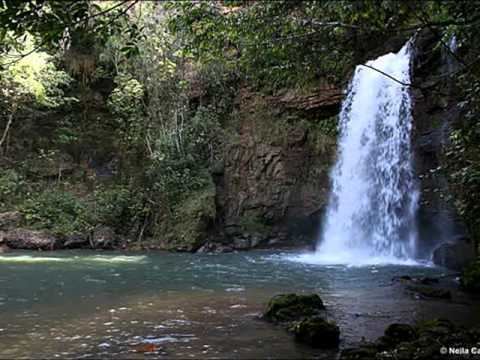
This area has great touristic potential. Unpolluted rivers, rapids, waterfalls, peaks, and caves make it a much sought-after touristic destination. The Emas National Park lies to the west.
There are at least forty caves with paintings left by earlier inhabitants. These show figures of lizards, emas, and parrots and also geometric designs.