
Municipality Los Angeles | ||
 | ||
East end | ||
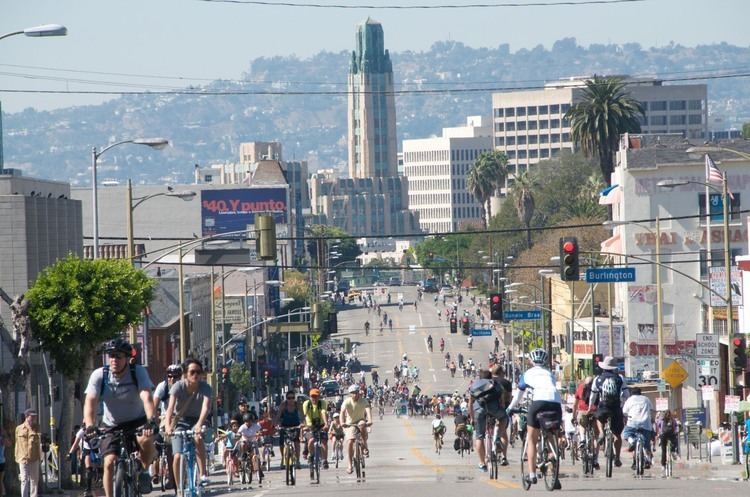
Los angeles driving tour driving to ocean on america s richest street wilshire boulevard in rain
Wilshire Boulevard (/ˈwɪlʃər/ WIL-shər) is one of the principal east-west arterial roads in Los Angeles, California.
Contents
- Los angeles driving tour driving to ocean on america s richest street wilshire boulevard in rain
- Map of Wilshire Blvd California USA
- Subway
- Metro
- Features
- MacArthur Park connection
- The boulevard from west to east
- Landmarks from west to east
- Major intersections
- In popular culture
- References
Map of Wilshire Blvd, California, USA
Much of the length of the road can be traced back to the indigenous Tongva people who used it to bring back tar from the La Brea pits in today's Miracle Mile section of Wilshire Blvd, back to their settlement on the coast. This road was later used by Spanish explorers and settlers, calling it El Camino Viejo ('The Old Road'). The route that ultimately became Wilshire crossed the original pueblo of Los Angeles and five of the original Spanish land grants, or ranchos.
Wilshire was pieced together from various streets over several decades. It began in the 1870s as Nevada Avenue in Santa Monica, and in the 1880s as Orange Street between Westlake (now MacArthur) Park and downtown. Nevada and Orange were later renamed as parts of Wilshire.
The boulevard was named for Henry Gaylord Wilshire (1861–1927), an Ohio native who made and lost fortunes in real estate, farming, and gold mining. In 1895 he began developing 35 acres of a barley field, stretching westward from Westlake Park for an elite residential subdivision, and donated to the city a strip of land 120 feet wide by 1,200 feet long for a boulevard, on the conditions that it would be named for him and that railroad lines and commercial or industrial trucking would be banned. The road first appeared on a map under its present name in 1895. A historic apartment building on the corner of Wilshire Blvd. and S. Kenmore Ave., the Gaylord, carries his middle name.
Running 15.83 miles (25.48 km) from Grand Avenue in Downtown Los Angeles to Ocean Avenue in the City of Santa Monica, Wilshire Boulevard is densely developed throughout most of its span, connecting five of Los Angeles's major business districts to each other, as well as Beverly Hills. Many of the post-1956 skyscrapers in Los Angeles are located along Wilshire; for example, One Wilshire, built in 1966 at the junction of Wilshire and Grand, is said to be "...the main hub of the internet for the entire Pacific Rim" due to the large concentration of telecommunications companies renting space there. Aon Center, at one point Los Angeles' largest (and presently second-largest) tower, is at 707 Wilshire Boulevard in downtown Los Angeles.
The Wilshire Boulevard home of J. Paul Getty was used as the filmset for the 1950 film Sunset Boulevard: it was demolished in 1957.
One particularly famous stretch of the boulevard between Fairfax and Highland Avenues is known as the Miracle Mile. Many of Los Angeles' largest museums are located there. The area just to the east of that, between Highland Avenue and Wilton Place, is referred to as the "Park Mile". Between Westwood and Holmby Hills, several tall glitzy condominium buildings overlook this part of Wilshire, giving it the title of Millionaire's Mile. This section is also known as the Wilshire Corridor and Condo Canyon.
The Wilshire Corridor, located next to Century City, is one of Los Angeles' busiest districts, and contains many high-rise residential towers. The Fox and MGM studios are located in a series of skyscrapers, along with many historic Los Angeles hotels.
Wilshire Blvd is also the principal street of Los Angeles Koreatown, the site of many of Los Angeles' oldest buildings, as well as skyscrapers. Koreatown and Mid Wilshire are among Los Angeles's densest districts.
Subway
The Purple and Red subway lines of the LACMTA run along Wilshire Boulevard from just past the 7th/Figueroa Street station before serving the Westlake/MacArthur Park and Wilshire/Vermont stations, where the Purple Line continues along Wilshire to serve two stations at Normandie Avenue and at Western Avenue in Koreatown, while the Red Line branches off to terminate in North Hollywood.
The construction of the future Purple Line Extension Section 1 commenced in November 2014. The construction timeline would see the project from the existing Wilshire/Western station to the planned Wilshire/La Cienega station on the corner of Wilshire and La Cienega Boulevard, to be completed by 2023. The phase two and three of the Purple Line, when fully completed, will extend to Westwood/VA Hospital, and will follow Wilshire Blvd for most of its route. Phase four to Santa Monica Beach are still in the planning stages and expected to be completed somewhere between 2022 and 2036, depending on funding.
Metro
Metro Local Line 20, Metro Rapid Line 720, and Santa Monica Transit Line 2 operate along Wilshire Boulevard. Due to the high ridership of line 720, 60-foot (18 m) NABI articulated buses are used on this route, and bus lanes are in place along some segments of the line.
Features
All of the boulevard is at least four lanes in width, and most of the portion between Hoover Street and Robertson Boulevard has a raised center median. The widest portion is in the business district of central Westwood, where mobs of pedestrians crossing Wilshire at Westwood Boulevard must traverse ten lanes (including two left-turn pockets). According to a 1991 study by the Los Angeles Department of Transportation, this and the nearby intersection of Wilshire and Veteran are among the busiest in Los Angeles. The boulevard's widest portion is in Westwood and Holmby Hills, where it expands to six, and briefly, eight lanes.
The sections of Wilshire Boulevard in the city of Los Angeles are notorious for their giant potholes.
MacArthur Park connection
Wilshire Boulevard formerly ended at the MacArthur Park lake, but in 1934 a berm was built for it to cross and link up with the existing Orange Street (which ran from Figueroa to Alvarado) into downtown Los Angeles. Orange Street was renamed Wilshire and extended east of Figueroa to Grand. This divided the lake into two halves; the northern half was later drained.
The boulevard from west to east
Wilshire Boulevard runs through the following:
Landmarks from west to east
Major intersections
The entire route is in Los Angeles County.
In popular culture
In the realm of music, American singer Lana Del Rey references Wilshire Boulevard in her song "Honeymoon," featured on her 2015 album bearing the same title. Similarly, American rapper Nipsey Hussle mentions this iconic boulevard in the track "Dreamin'," from his fifth mixtape, "The Marathon." The 1997 film Volcano features the boulevard being destroyed by volcanic lava. On March 9, 1997, American East Coast rapper The Notorious B.I.G. was seated in the front passenger seat of an SUV, which came to a stop at the red light at the intersection of Wilshire and Fairfax. Another vehicle pulled up next to them, and the driver drew out a pistol and shot B.I.G. four times in a drive-by shooting, killing him.