
Length 496 km | Discharge 137 m³/s | |
 | ||
Similar Atlas Mountains, Middle Atlas, Anti‑Atlas, High Atlas, Al Wahda Dam | ||
Sebou (Berber: Asif n Sbu, Arabic: سبو) is a river in northern Morocco. At its source in the Middle Atlas mountains it is known as the Guigou River (Berber: Asif n Gigu). The river is 496 kilometers long and has an average water flow of 137 m3/s, which makes it the largest North African river by volume. It passes near the city of Fes and discharges to the Atlantic Ocean in Mehdia. Sebou is navigable for only 16 km as far as the city of Kenitra, which has the only river port in Morocco. Its most important tributaries are the Ouergha River, Baht River and Inaouen River. The river supports irrigation in Morocco's most fertile region: the Gharb.
Contents
- Map of Sebou River Morocco
- Geography of the Sebou River
- Origin and Course of the Sebou River
- Tributaries
- Climate of the Sebou River Basin
- Hydrology and Water Management
- Irrigation and Agriculture
- Major Dams and Reservoirs in the Sebou River Basin
- Ecology and Biodiversity of the Sebou River
- Historical Significance and Cultural Heritage
- Environmental Issues
- References
Map of Sebou River, Morocco
Geography of the Sebou River
Origin and Course of the Sebou River
The Sebou River, an essential water resource in Morocco, has its origin in the Middle Atlas Mountains and meanders through various landscapes before reaching the Atlantic Ocean. The river's journey can be divided into several distinct sections, each characterized by unique geographical features and ecological environments.
Source and upper course
The Sebou River originates from the Middle Atlas Mountains, near the town of Guigou, at an elevation of about 2,000 meters above sea level. The river begins as a small stream, fed by snowmelt and rainfall from the surrounding peaks. As it flows down the mountain slopes, the Sebou River is joined by numerous tributaries, gradually increasing in size and water volume.
Middle course : Rif Mountains and Fes-Boulemane region
As the Sebou River continues its northward journey, it enters the Rif Mountains, a rugged terrain characterized by steep slopes, narrow valleys, and fast-flowing streams. This section of the river is marked by numerous rapids and waterfalls, making navigation difficult. The river also passes through the Fes-Boulemane region, an area known for its rich history and cultural heritage. The city of Fes, one of Morocco's oldest and most significant urban centers, is located near the Sebou River, which has played a vital role in its development throughout history.
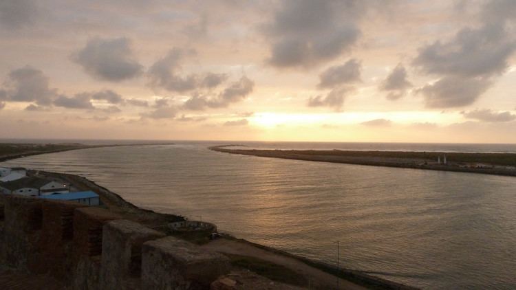
Lower course : Gharb Plain and Atlantic Ocean
As the Sebou River leaves the Rif Mountains, it enters the Gharb Plain, a vast and fertile agricultural region that stretches between the Atlantic coast and the foothills of the Rif and Middle Atlas Mountains. This flat, alluvial plain is the heart of Morocco's agricultural production, and the Sebou River serves as its lifeblood, providing water for irrigation and supporting a variety of crops, including cereals, citrus fruits, and vegetables. The river's flow slows down considerably in this area, meandering through the plain and forming numerous oxbow lakes and wetlands. Finally, after a journey of approximately 500 kilometers, the Sebou River reaches the Atlantic Ocean near the city of Kenitra. The river's delta is an ecologically significant area, home to a variety of bird species and providing vital habitats for both migratory and resident populations. In summary, the Sebou River's course, from its origin in the Middle Atlas Mountains to its terminus at the Atlantic Ocean, traverses a diverse range of landscapes and ecosystems. The river has played a crucial role in shaping the region's geography, ecology, and human history, serving as a vital water source for agriculture, industry, and local communities along its path.
Tributaries
Ouergha River
The Ouergha River is one of the primary tributaries of the Sebou River, originating in the Rif Mountains. The river meanders through agricultural lands, small towns, and rural settlements, providing a vital source of water for farming and domestic use. The Ouergha River, stretching about 345 kilometers, meets the Sebou River near the city of Kenitra.
Inaouen River
The Inaouen River is another crucial tributary, rising from the Middle Atlas Mountains. This 240-kilometer-long river supports agricultural activities and contributes to the region's biodiversity.The Inaouen River converges with the Sebou River near the city of Fes, which is famous for its historic architecture and ancient medina.
Beht River
Originating in the Middle Atlas Mountains, the Beht River is a significant tributary that courses through fertile valleys and agricultural lands. The Beht River, approximately 190 kilometers in length, merges with the Sebou River close to the city of Meknes. The river is also crucial for the region's irrigation and hydroelectric power generation.
Mikkes River
The Mikkes River, which is approximately 100 kilometers long, is another vital tributary of the Sebou River. It originates in the Middle Atlas Mountains and flows through picturesque landscapes, eventually joining the Sebou River close to the town of Taounate. The Mikkes River is essential for the region's agricultural activities, supplying water for crop irrigation.
Climate of the Sebou River Basin
Climate of the Sebou River Basin
The Sebou River basin spans an area with diverse climatic conditions, ranging from Mediterranean climates in the coastal areas to semi-arid conditions in the Middle Atlas Mountains. The coastal regions have mild, wet winters and warm, dry summers, while the inland and mountainous areas experience colder temperatures and more significant variations in precipitation.
Precipitation Patterns
The Sebou River basin receives the majority of its precipitation during the winter months, with rainfall levels varying depending on the altitude and geographic location. Coastal areas receive an annual average of 500-700 millimeters of rainfall, while the Middle Atlas Mountains can experience up to 1,000 millimeters. Precipitation is scarce during the summer months, which can lead to reduced river flow and potential water shortages.
Temperature Variations
The temperature in the Sebou River basin varies depending on the location and altitude. Coastal areas experience mild temperatures, with average highs ranging from 17°C in the winter to 27°C in the summer. In contrast, the Middle Atlas Mountains have more significant temperature fluctuations, with average winter lows reaching -2°C and summer highs around 30°C.
Seasonal Variations of the Sebou River
The flow and discharge of the Sebou River are heavily influenced by seasonal precipitation patterns and temperature variations.
Winter and Spring
During the winter months, the Sebou River and its tributaries experience increased flow due to high levels of precipitation. The river's discharge is generally at its highest during this period, resulting in better water quality and availability for agriculture and domestic use. The river also experiences snowmelt from the Middle Atlas Mountains during the spring, further contributing to increased flow.
Summer and Autumn
The summer months bring reduced precipitation levels and higher temperatures, leading to a decrease in the Sebou River's flow and discharge. This decrease can result in lower water quality and availability, impacting agriculture, domestic use, and the river's biodiversity. During the autumn, precipitation levels begin to increase gradually, contributing to an improvement in the river's flow and water quality.
Conclusion
The climate and seasonal variations of the Sebou River have a significant impact on the river's flow, water quality, and overall health. Understanding these variations is crucial for sustainable water management practices and the conservation of the Sebou River basin's biodiversity. As climate change continues to alter precipitation patterns and temperature fluctuations, adaptive management strategies will become increasingly important to ensure the long-term vitality of the Sebou River and the communities that rely on it.
Hydrology and Water Management
Irrigation and Agriculture
Irrigation
Irrigation plays a significant role in the agricultural sector of the Sebou River Basin, enabling farmers to cultivate various crops, such as cereals, vegetables, fruits, and sugarcane. Given the irregular precipitation patterns and seasonal variations in water discharge, effective irrigation is essential for ensuring crop productivity and food security. The region utilizes various irrigation methods, including traditional surface irrigation, sprinkler systems, and drip irrigation.
Agriculture
Agriculture is the backbone of the regional economy in the Sebou River Basin, providing livelihoods for a significant proportion of the population. The Gharb plain, one of the most fertile areas in Morocco, benefits from the river's water resources, supporting the cultivation of a wide range of crops. The primary agricultural products in the region include cereals, such as wheat and barley, along with fruits like oranges and olives. The Sebou River also supports the growth of cash crops, such as sugarcane, which contribute to the region's economic prosperity.
Major Dams and Reservoirs in the Sebou River Basin
Idriss I Dam and Reservoir
Located on the Inaouen River, a major tributary of the Sebou River, the Idriss I Dam was completed in 1973. The dam is named after Idriss I, the founder of the Idrisid dynasty in Morocco. The Idriss I Reservoir has a storage capacity of approximately 1.45 billion cubic meters, making it one of the largest reservoirs in the Sebou River basin. It serves multiple purposes, including irrigation, flood control, and hydroelectric power generation.
Al Wahda Dam and Reservoir
The Al Wahda Dam, situated on the Ouergha River, another primary tributary of the Sebou River, was completed in 1996. It is the second-largest dam in Morocco and one of the largest earth-fill dams in Africa. The Al Wahda Reservoir has a storage capacity of around 3.7 billion cubic meters. The dam's primary purposes include water supply for irrigation, flood control, and hydroelectric power generation, with an installed capacity of 125 MW.
Sidi Chahed Dam and Reservoir
The Sidi Chahed Dam, located on the Beht River, a significant tributary of the Sebou River, was completed in 2000. The dam's primary purpose is to supply water for irrigation and domestic use to the nearby city of Meknes and its surrounding agricultural lands. The Sidi Chahed Reservoir has a storage capacity of approximately 65 million cubic meters.
Ecology and Biodiversity of the Sebou River
Ecology of the Sebou River
The Sebou River basin is characterized by a variety of ecosystems, each supporting diverse plant and animal life. The river itself acts as an essential habitat for numerous fish species, including the European eel (Anguilla anguilla), the Moroccan trout (Salmo trutta macrostigma), and the endangered Atlantic sturgeon (Acipenser sturio). These species depend on the river for spawning, feeding, and refuge.
Wetlands in the Sebou River basin, such as the Merja Zerga and Dayet Aoua, are of critical ecological importance, providing nesting sites for migratory birds and supporting a myriad of plant species. These wetlands serve as a sanctuary for several threatened bird species, including the marbled teal (Marmaronetta angustirostris), the white-headed duck (Oxyura leucocephala), and the black-crowned night heron (Nycticorax nycticorax).
Forests around the Sebou River basin are also home to a rich array of flora and fauna. The Middle Atlas cedar forests, for example, harbor the endangered Barbary macaque (Macaca sylvanus) and the endemic Atlas cedar (Cedrus atlantica). In addition, these forests serve as crucial carbon sinks and are vital for maintaining the region's hydrological balance.
Agricultural lands within the Sebou River basin support numerous plant and animal species, including the endangered Egyptian mongoose (Herpestes ichneumon) and various bird species such as the lesser kestrel (Falco naumanni) and the Montagu's harrier (Circus pygargus).
Historical Significance and Cultural Heritage
Historical Significance
Ancient Settlements
The Sebou River has been a source of life and sustenance for many civilizations throughout history. The region around the river has been inhabited since prehistoric times, with archaeological evidence indicating the presence of settlements dating back to the Neolithic period.
Phoenician and Roman Influence
The strategic location of the Sebou River made it an important center for trade and cultural exchange. The Phoenicians, an ancient civilization from the Eastern Mediterranean, established trading posts and settlements along the river, furthering the exchange of goods, ideas, and culture. Later, the Romans conquered the region, using the Sebou River as a key transport route and incorporating it into their vast empire.
Islamic Conquests and Berber Dynasties
The Sebou River played a significant role in the Islamic conquest of North Africa. The Arab and Berber armies used the river to traverse the region and establish a series of Berber dynasties that ruled Morocco for centuries. The river's importance continued during the reign of the Almoravids, Almohads, and Merinids, with several cities and fortresses built along its banks.
Cultural Heritage
Traditional Agriculture
The Sebou River has long been central to the livelihoods of the people living in its basin. The fertile lands along the river have supported traditional agricultural practices, including the cultivation of cereals, olives, and citrus fruits. The river also supports livestock and poultry farming, contributing to the region's rich culinary traditions.
Artisanal Craftsmanship
The Sebou River region is known for its skilled craftsmen, who have passed down their knowledge and expertise through generations. These artisans are particularly known for their work in pottery, wood carving, and textiles, with the production of carpets and rugs being a notable example of the region's rich cultural heritage.
Festivals and Celebrations
The communities along the Sebou River have a variety of local festivals and celebrations that showcase their unique cultural traditions. These events often revolve around the agricultural calendar, with harvest festivals being particularly significant.
Architectural Heritage
The Sebou River has witnessed the rise and fall of numerous civilizations, each leaving behind a unique architectural footprint. The region is dotted with remnants of Roman ruins, Islamic palaces, and traditional Moroccan houses known as riads.
Environmental Issues
A number of water pollutants enter the Sebou River, notably including pesticides and fertilisers from agricultural runoff and untreated sewage from towns along the river.