
Elevation 4,167 m Highest point Toubkal | Area 77,938 km² | |
 | ||
Peak Jbel Toubkal Berber: ⵜⵓⴱⴽⴰⵍ) Mountains Toubkal, M'Goun, Jbel Ayachi, Ouanoukrim, Jebel Yagour Similar Atlas Mountains, Toubkal, Anti‑Atlas, Middle Atlas, Todgha Gorge | ||
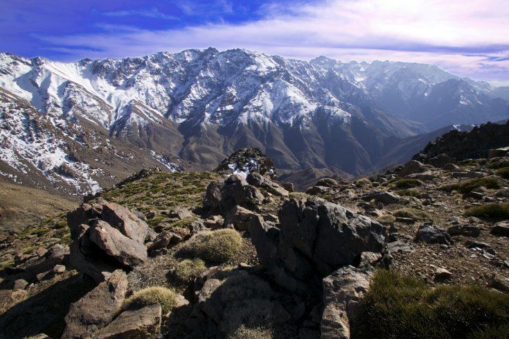
A perilous pass in the high atlas mountains morocco
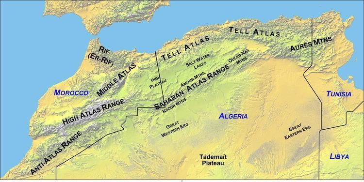
High Atlas, also called the Grand Atlas Mountains (Arabic: الاطلس الكبير; French: Haut Atlas; Berber: ⴰⴷⵔⴰⵔ ⵏ ⴷⵔⵏ) is a mountain range in central Morocco in Northern Africa.
Contents
- A perilous pass in the high atlas mountains morocco
- High atlas mountains morocco 17 sept to 1 oct 2016
- Climate
- Western High Atlas
- Central High Atlas
- Eastern High Atlas
- Areas of interest
- References
The High Atlas rises in the west at the Atlantic Ocean and stretches in an eastern direction to the Moroccan-Algerian border. At the Atlantic and to the southwest the range drops abruptly and makes an impressive transition to the coast and the Anti-Atlas range. To the north, in the direction of Marrakech, the range descends less abruptly.
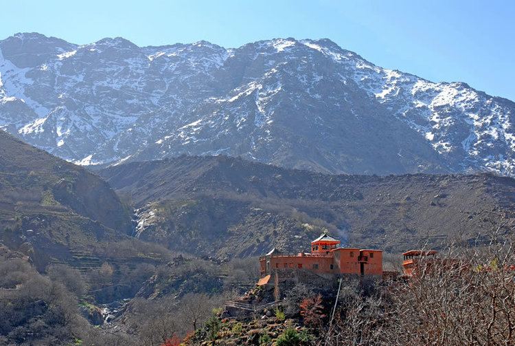
The range includes Jbel Toubkal, which at 4,167 m is the highest in the range and lies in Toubkal National Park. The range serves as a weather system barrier in Morocco running east-west and separating the Sahara from the Mediterranean and continental zones to the north and west. In the higher elevations of the massif, snow falls regularly, allowing winter sports. Snow lasts well into late spring in the High Atlas, mostly on the northern faces of the range. On the Western High Atlas, there is Oukaïmeden, one of three main ski stations in Morocco.
The High Atlas forms the basins for a multiplicity of river systems. The majority of the year-round rivers flow to the north, providing the basis for the settlements there. A number of wadis and seasonal rivers terminate in the deserts to the south and plateaux to the east of the mountains.
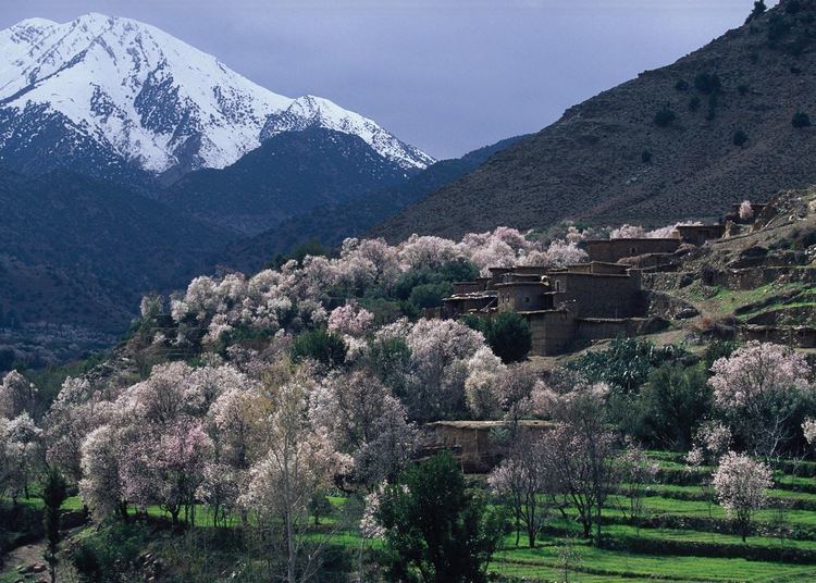
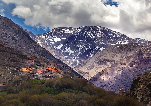
The High-Atlas Mountains are inhabited by Berbers, who live from agriculture and pastoralism in the valleys. In the steppe zone of the High-Atlas, where precipitations are low, the locals created a smart technique in managing the low precipitations and the weak soil. They turn the rather semi-arid lands into fertile valleys called locally by Agdal (garden in Berber). This technique has intrigued many Western agriculturalists, in which they were impressed by the high efficiency of this agricultural system. Many scientists, particularly French scientists, make yearly expeditions to observe the community and their living system.
High atlas mountains morocco 17 sept to 1 oct 2016
Climate
There are two types of Alpine Climates in the High Atlas:
Oceanic climate, dominates the north and south of the Western High Atlas until (Jbel Toubkal), as well as the northern part of Central High Atlas from Jbel Toubkal until Imilchil, owing to their exposition to the perturbations coming from the North Atlantic Ocean. These regions are relatively humid with irregular precipitations but occasionally torrential. Generally, it falls annually between 600 mm to 1000 mm. The drought in the summer months, interrupted by thunderstorms, is usually intense. Snow falls between November and April, but can persist from September to June in the peaks. Important rivers flow through the valleys (Asif Melloul, Oued n'Fis, Oued Tessaout, etc.) supply the fertile basins like Aït Bou Guemez and Imilchil. These conditions allow the existence of pine, oak and cedar forests. However, these forests are declining because of the reducing of annual precipitation, over-exploitation of the trees (used for construction and heating), and sheep-goat overgrazing.
The other type of climate is continental semi-arid or steppe climate, and is present in the southern part of the Central High Atlas, from Toubkal to Imilchil, and the whole Oriental High-Atlas down of Imilchil. These regions are marked by variations in temperatures. It extends southward from the steppe lands into rocky desert. In addition, some localized valleys supplied by irrigation make agriculture possible. Forests are almost rare. This portion of High-Atlas is very similar to the Rocky Mountains in the western United States.
Western High Atlas
In the west lies the oldest portion of the range. Its high point is the Jbel Toubkal at 4167 m, which is visible from the city of Marrakech. Jbel Toubkal lies in the Toubkal national park, which was created in 1942. The massif consists of Jurassic and Cretaceous formations notched by deep erosion-carved valleys. This part of the range includes the Ourika Valley, which is the only location in the High Atlas where the endangered primate, the Barbary macaque, Macaca sylvanus, is found; however, this primate is also found in parts of the Middle Atlas and the Rif, as well as parts of Algeria. The Ourika Valley is also a location where a diverse flora was recorded as early as the 19th century.
Central High Atlas
A solid chalk mass morphologically dominated by tabular zones reaching an altitude of 2,500 m extends from Azilal to Ouarzazate. Here, the contrasting landscapes are similar to Colorado in the United States, with high plateaux, gorges and box canyons, and peaks sometimes splintered by erosion. Several peaks in this area exceed 4000 m, with Jbel Mgoun at 4068 m being the highest peak in this part of the High Atlas. The area is populated by Berbers.
Eastern High Atlas
The eastern part of the High Atlas forms vast plateaux at high altitude which provide the headwaters for the Moulouya River. It extends from the town of Khenifra and includes oases at Jbel Ayachi (at 3747 m), Jbel Saghro and Jbel Sirwa (3305 m). This portion of the range includes the solid mass of the Tamlelt whose northern edge is occupied by its higher peaks, such Jbel Ayachi at 3,747 m. The altitude falls towards the east where the mountains join the pre-Saharan zone.
This massif became an internationally famous paleontological site after the discovery of the bones of the completely unknown ancestor of the dinosaurs, Atlasaurus, which populated Morocco 180 million years ago. This dinosaur is also named Tazoudasaurus, after the name of the village of Tazouda where it was discovered. The creature, about nine metres long, is postulated to be an ancestor of the Sauropoda found in America. Until 140 million years ago the African and American continents were connected.
Areas of interest
Travel over the high mountain passes is worthwhile. At the foot of the High Atlas one finds Aït Benhaddou, a ksar or fortified village still in use. The ksar has been so widely used in films that it is sometimes referred to as "Moroccan Hollywood".
At approximately mid-range, the Amesfrane Rock Wall rises some 1,650 feet (500 m) from a dry riverbed wadi. The formation is composed of rounded columns patterned with horizontal ridges that occurred as a result of erosion, which caused travellers to nickname it "the Cathedral", for its resemblance to a gothic cathedral.
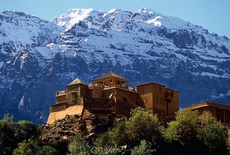
Among the summits at 1600 m height lies the Kasbah of Telouet on the road to Marrakech.
The canyons and ravines of the Dadès and the Todra are also points of interest.