
ISO 3166 code MA-02 | Time zone WET (UTC+0) Area 8,805 km² | |
 | ||
Points of interest Horloge Ouazzane, Espace jeu pour enfants, Plage Sidi Boughaba, Al Wahda Dam | ||
Gharb-Chrarda-Béni Hssen (Arabic: الغرب شراردة بني حسين) was formerly one of the sixteen regions of Morocco from 1997 to 2015. It was situated in north-western Morocco, covers an area of 8,805 km² and has a population of 1,904,112 (2014 census). The capital was Kenitra.
Contents
- Map of Gharb Chrarda Beni Hssen Morocco
- Administrative divisions
- Antiquity
- Geography
- Oil and gas
- Demographics
- Agricultural productivity
- References
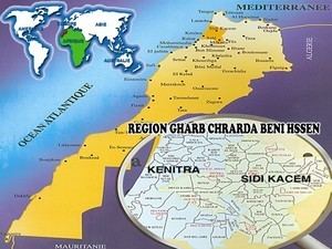
Map of Gharb-Chrarda-Beni Hssen, Morocco
The region lacks economic and geographic unity. In particular, while it resembles and is closely connected with the Loukos region which is administrated by the Tanger-Tétouan region, the Gharb is ruled from Kenitra with which it has little connections. Kenitra itself is integrated in the urban corridor that extends southward through Rabat and Casablanca to El Jadida.
Administrative divisions
The region consisted of the following provinces:
Antiquity
In ancient times this region was part of Mauretania Tingitana, which was ruled in early times by the Phoenicians and later by the Mauretanians and Romans. Major settlements from these eras were located at Volubilis and at Chellah.
Geography
The administrative region extends about 80 kilometres (50 mi) along the coast of Morocco and about 90 kilometres (56 mi) inland. The major river is the Sebou River which flows west out of the Al Wahda Dam in eastern Gharb, past Jorf El Melha and Mechra Bel Ksiri after which it turns southwest and flows through Kenitra, where it is navigable below that point. Most of the region is located in the Gharb Basin (Rharb Basin) which forms a low-land plain extending west and southwest from the Prerif Ridges of the Rif Mountains to the east and northeast. The town of Souq Larb’a al-Gharb is centrally located within the basin. The Gharb Basin covers an area of some 4,000 square kilometres (1,500 sq mi).
Kenitra is the largest city, with Sidi Slimane and Sidi Kacem being second and third.
Oil and gas
The Gharb Basin has been explored for oil and gas since the 1920. Commercial production of natural gas began in 1963, with new fields being brought on line through the 1990s. The gas is generally found is shallow deposits at a depth ranging from 900 m to 1800 m.
Demographics
From 2004 to 2014 the area experienced a modest 2.3% growth in population from 1,859,540 to 1,904,112, available water being the main limitation on growth.
Agricultural productivity
The Gharb is the second most important agricultural region of Morocco after Tadla-Azilal. In 2001, there were officially 91,800 hectares irrigated plus about 20,000 hectares with pumps directly accessing the oueds. Together with the Loukos region it produces some 95% of Morocco's rice, 75% of the country's production of sugar cane, 50% of the oleaginous plants, as well as 65% of the strawberries exported by Morocco.
Historically the Gharb Basin has been developed for numerous agricultural purposes ranging as widely as eucalyptus farms to beekeeping.
The colons under French rule (as further North under Spanish rule in the Loukos valley) were fully conscious of the region's production capacities and settled in the Gharb in large numbers. About 800 farms covered some 200,000 hectares (a fourth of the region's total). Two lesser urban centers arose from colonization: Mechra Bel Ksiri and Sidi Slimane.
A number of factories have been created to process some of the Gharb's agricultural production. For instance, there are now five sugar refineries. The development of the Gharb region relies heavily on the dams Idriss I on the Inaouen River and Al Wahda Dam on the Ouerrha both for electricity and irrigation. Headwaters for these rivers lie in the Middle Atlas region, where prehistorically the upper watershed supported much more vigorous and extensive forests, such that flooding was moderated and year round flow was increased compared to current times.
The center of the region is the most productive, but there has been recent development in the west along the ocean. On the other hand the southern and eastern parts of the region remain marginal and pauperized.