
- land 0.32 sq mi (1 km) - summer (DST) CDT (UTC-5) Local time Friday 3:53 PM Postal code 61475 | - water 0.00 sq mi (0 km) Area 83 ha Population 61 (2013) Area code 309 | |
 | ||
Weather 24°C, Wind W at 27 km/h, 35% Humidity | ||
Sciota /saɪˈoʊdə/ is a village in McDonough County, Illinois, United States. The population was 61 at the 2010 census.
Contents
Map of Sciota, IL 61475, USA
Geography
Sciota is located at 40°33′39″N 90°45′06″W (40.5608731, -90.7517996) at an elevation of 758 ft (231 m). According to the 2010 census, Sciota has a total area of 0.32 square miles (0.83 km2), all land.
The village of Sciota lies in an area of prime farmland with soil classified as Mollisols.
Sciota is situated directly east of the headwaters of an unnamed tributary of Spring Creek, itself a tributary of the East Fork La Moine River.
Demographics
As of the 2010 census, there were 61 people, 26 households, and 12 families residing in the village. The racial makeup of the village was 100.00% White.
History
Sciota was laid out in September 1867 by William B. Clarke and was called Clarkesville in his honor. Another town in Illinois already had been named Clarksville (without the "e") so when the new town's post office was established on February 7, 1868, it was called Amicus. This discrepancy between town name and post office name led the residents to change both names to Sciota, after Sciota Township in which the town lies (Sciota Township was named after the Scioto River in Ohio). The Illinois General Assembly approved the name change on March 29, 1869.
A Christian church was erected in 1869, a Baptist church in 1871, and a school building in 1872.
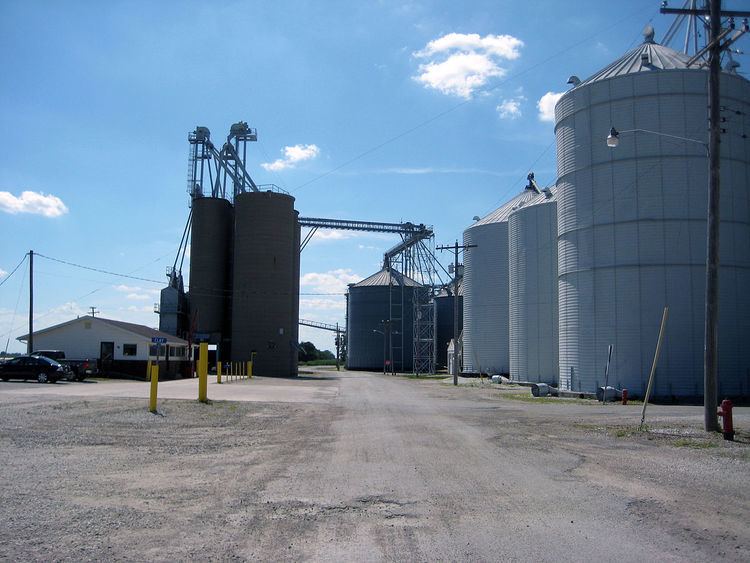
In 1878, Sciota was the largest grain market in McDonough County. At that time, the primary crops were corn and oats; now, the village is surrounded by fields of corn and soybeans.
A newspaper, The Sciota Sentinel, was published by H. C. Harl around 1895 but only one issue seems to have survived (October 17, 1895, no. 49).
Transportation and infrastructure
Sciota is accessible by public roads from the south via McDonough County road East 800th Street (County Highway 13) which intersects with Illinois Route 9 1/2 mile south of the village. East 800th Street is called Buel Street within the village proper and extends north to the county line.
Sciota is served by the Keokuk Junction Railway. As of January 2010, there were two rail sidings. There is one grade crossing protected by a pair of crossbucks with flashing lights and a mechanical warning bell (no gates).
The village received a state grant of $400,000 in 2001 to connect to the Good Hope water supply system and to build a water tower. While Sciota has a water supply system, it does not have a sanitary sewer system; residents rely on septic systems for sewage disposal.