
Vehicle registration HA Area 69.67 km² Local time Friday 4:08 AM Area code 06244 | Time zone CET (UTC+1) Elevation 487 m Population 1,302 (1 Apr 2009) Postal code 5440 | |
 | ||
Website www.scheffau.salzburg.at Weather 7°C, Wind SW at 5 km/h, 83% Humidity | ||
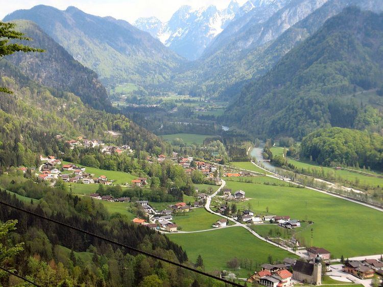
Scheffau am Tennengebirge is a municipality in the Hallein district of Salzburg, Austria.
Contents
Map of 5440 Scheffau am Tennengebirge, Austria
Geography
The municipality of Scheffau am Tennengebirge lies in the southern Tennengau of the Salzburger Land. The River Lammer flows through its territory. Its subordinate parishes are: Unterscheffau, Oberscheffau, Voregg, Wallingwinkl, Weitenau. Its Katastralgemeinden are Scheffau, Voregg und Weitenau.
The villages lies at the foot of the Tennengebirge mountain range that rises to a height of 2,300 m (7,500 ft) and, to the south, forms the boundary with Pongau. To the north the municipality includes part of the Ostern Group which is up to 1,600 m (5,200 ft) high. The centre of the municipality is in the Lammer valley in Unterscheffau and Oberscheffau.
References
Scheffau am Tennengebirge Wikipedia(Text) CC BY-SA