
 | ||
1672.2 | ||
Bnsf scenic subdivision leavenworth and skykomish 4k
The Scenic Subdivision or Scenic Sub is a railway line running about 155 miles (249 km) from Seattle, Washington to Wenatchee, Washington. It is operated by BNSF Railway as part of their Northern Transcon and contains the Cascade Tunnel as well as the final spike completion site, in 1893, at Scenic Hot Springs, for the whole Great Northern Railway transcontinental railway line built by James J. Hill.
Contents
- Bnsf scenic subdivision leavenworth and skykomish 4k
- Train s eye view on bnsf scenic subdivision washington state
- Description
- References
Current operations are limited to 30 trains per day due to ventilation capacity with the Cascade Tunnel.
Train s eye view on bnsf scenic subdivision washington state
Description
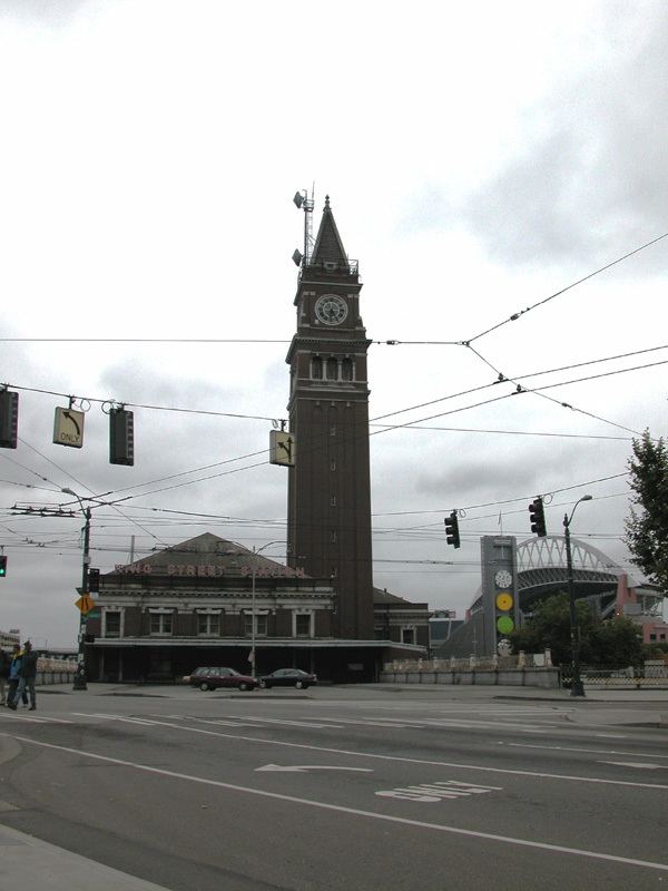
Traveling east from the King Street Station in Seattle, the main line of the BNSF heads north through the Great Northern Tunnel under downtown Seattle. After exiting the tunnel the main line continues north through the Interbay neighborhood and the Balmer classification yard (which also has regional locomotive maintenance facilities). The line then crosses the Lake Washington Ship Canal on the Salmon Bay Bridge and passes through the Ballard neighborhood. A notable fact is the lines passes right through the Golden Gardens Park in Ballard, which has been the site of many fatalities connected to pedestrians crossing the tracks and other numerous non-fatal incidents.
The main line then continues north along the shore of Puget Sound through the cities of Edmonds and Mukilteo, past Rucker Hill, near downtown Everett, to the old Everett Station, built by the Great Northern Railway in 1900. This section of the main line from Seattle to Everett is mostly double track with BNSF planning to double track the remaining single track, in conjunction with changes planned by Sound Transit. From the old Everett Station the main line becomes single track making a nearly 180 degree turn through a partially covered cut through downtown Everett to the new Everett Station.
From the new station, the main line heads southeast along the Snohomish River through the cities of Snohomish and Monroe. From Monroe the main line follows the Skykomish River through the towns of Index and Skykomish to the western portal of the newest Cascade Tunnel. East of Everett the route is single track except for passing sidings. To the east of Gold Bar, the route is mainly located on narrow ledges as it crosses back and forth across the Skykomish, South Fork of the Skykomish, and the Foss Rivers. A steep ascent/descent (2.2%) starts in the vicinity of eastern Skykomish and continues through the tunnel to Merritt. At Skykomish are facilities for turning equipment, mainly for snow fighting. Skykomish was also the end of electrification when the line was electrified from Wentachee to Skykomish in 1928-1929. A new electrical power plant was sited (also in 1928) there as well but is now demolished.
After summiting the Cascade Range near Berne the line starts a steep (2.2%) descent to Merritt. The Gaynor Tunnel is located between Berne and Merritt. Merritt is the site of a maintenance base with a turning facility for snow fighting equipment. To the east of Winton was the junction with the original right of way, and a line relocation project (circa 1928) which added three tunnels (Winton, Swede and Chumstick Tunnels), called the Chumstick Cutoff. U.S. Route 2 is now located, on the original right of way, between this point and Leavenworth. Currently the railroad, now utilizing the Chumstick Cutoff, goes down the Chumstick Valley, after going through the Winton and Swede Tunnels, crossing the Wentachee River and then passing through the Chumstick Tunnel.
Up until the building of the Chumstick Cutoff (and the newest Cascade Tunnel) and the electrification of a majority of the subdivision in 1927–1929, Leavenworth was the division point. This was moved to the current Wentachee in 1928–1929.
Starting in the vicinity of Leavenworth, the current line follows the Wenatchee River valley all the way to the city of Wenatchee and the Columbia River. This area has a historic past, and is known for fruit production, particularly apples, pears and cherries. The railroad follows the river and goes through countless fruit groves as it passes the communities of Peshastin, Dryden, Cashmere, and Monitor in quick succession, before arriving in the Wenatchee area. At Wenatchee, there is a small industrial base, served by the railroad, as well as a yard (Appleyard), used, mainly, during the fruit harvest season.