
- elevation 0 m (0 ft) Discharge 269 m³/s Length 32 km | - location Port Gardner - min 763 cu ft/s (22 m/s) Basin area 4,807 km² | |
 | ||
- average 9,511 cu ft/s (269 m/s) - max 150,000 cu ft/s (4,248 m/s) Cities | ||
Snohomish river pink salmon
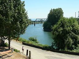
The Snohomish River is a river in the U.S. state of Washington, formed by the confluence of the Skykomish and Snoqualmie rivers near Monroe. It flows northwest entering Port Gardner Bay, part of Puget Sound, between Everett and Marysville. The Pilchuck River is its main tributary and joins the river at Snohomish. The river system drains the west side of the Cascade Mountains from Snoqualmie Pass to north of Stevens Pass.
Contents
- Snohomish river pink salmon
- Map of Snohomish River Washington USA
- Salmon fishing on the snohomish river wa snohopinko s 2011 part 1 osp
- References
Map of Snohomish River, Washington, USA
Measured at Monroe, the Snohomish River has an average annual flow of 9,500 cubic feet per second (270 m3/s). In comparison, the Columbia River, Washington's largest river, has an average flow of about 265,000 cubic feet per second (7,500 m3/s).
Salmon fishing on the snohomish river wa snohopinko s 2011 part 1 osp
References
Snohomish River Wikipedia(Text) CC BY-SA