
Country United States FIPS code 53-33175 Elevation 176 m Zip code 98256 Local time Saturday 9:04 PM | Time zone Pacific (PST) (UTC-8) GNIS feature ID 1521157 Area 60 ha Population 186 (2013) Area code 360 | |
 | ||
Weather 8°C, Wind SW at 16 km/h, 76% Humidity | ||
Index washington town center
Index is a town in Snohomish County, Washington, United States. The population was 178 at the 2010 census.
Contents
- Index washington town center
- Map of Index WA USA
- History
- Geography
- 2010 census
- 2000 census
- Economy
- Culture
- References
Map of Index, WA, USA
History
Prior to settlement by westerners, the Skykomish Indians lived in the area between Sultan and Index. They spoke Lushootseed; fishing the Skykomish River was an important part of their economy.
Logging and lumber booms in the latter half of the 19th century led to the growth of minor settlements in the eastern part of what became Snohomish County in 1861. A gold strike in 1889 at nearby Monte Cristo fueled another influx of prospectors and settlers. The town is named for nearby Mount Index.
Index was officially incorporated on October 11, 1907.
Geography
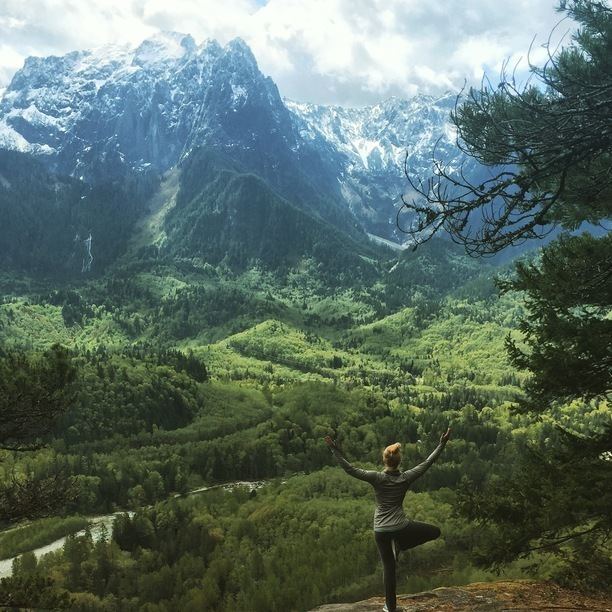
Index is located in the western foothills of the Cascade Mountains; the summit of Mount Index is located 3 miles (4.8 km) south of the town. The Index Town Walls, granite cliffs up to 500 feet (150 m) high, are located on the north edge of the town. These walls are a major destination for rock climbing, and are especially well known for a variety of high-quality cracks for climbing. According to the United States Census Bureau, the town has a total area of 0.23 square miles (0.60 km2), all of it land.
Index is located on the North Fork Skykomish River, just above its confluence with the main channel of the Skykomish River. The Skykomish River's Sunset Falls, a nearly 300-foot-long (91 m) granite chute that drops some 100 feet (30 m), is located approximately 1 mile (1.6 km) from the town (though on the South Fork Skykomish River).
The town is located 1 mile (1.6 km) north of US Highway 2, approximately 25 miles (40 km) west of Stevens Pass. The BNSF railroad, formerly the Great Northern Railway, runs through the middle of the town. And was once an important stop for the mining (particularly Monte Cristo and Galena) and timber activities north of its location.
2010 census
As of the census of 2010, there were 178 people, 80 households, and 44 families residing in the town. The population density was 773.9 inhabitants per square mile (298.8/km2). There were 116 housing units at an average density of 504.3 per square mile (194.7/km2). The racial makeup of the town was 95.5% White, 1.7% Asian, 0.6% Pacific Islander, 0.6% from other races, and 1.7% from two or more races. Hispanic or Latino of any race were 4.5% of the population.
There were 80 households of which 26.3% had children under the age of 18 living with them, 41.3% were married couples living together, 12.5% had a female householder with no husband present, 1.3% had a male householder with no wife present, and 45.0% were non-families. 41.3% of all households were made up of individuals and 12.5% had someone living alone who was 65 years of age or older. The average household size was 2.23 and the average family size was 3.02.
The median age in the town was 42 years. 22.5% of residents were under the age of 18; 5.6% were between the ages of 18 and 24; 24.1% were from 25 to 44; 35.5% were from 45 to 64; and 12.4% were 65 years of age or older. The gender makeup of the town was 47.2% male and 52.8% female.
2000 census
As of the 2000 census, there were 157 people, 75 households, and 39 families residing in the town. The population density was 620.3 people per square mile (242.5/km2). There were 100 housing units at an average density of 395.1 per square mile (154.4/km2). The racial makeup of the town was 95.54% White, 1.27% Native American, 1.27% Asian, and 1.91% from two or more races. Hispanic or Latino of any race were 1.91% of the population.
As of the 2000 census, there were 75 households, out of which 30.7% had children under the age of 18 living with them, 34.7% were married couples living together, 10.7% had a female householder with no husband present, and 48.0% were non-families. 36.0% of all households were made up of individuals, and 5.3% had someone living alone who was 65 years of age or older. The average household size was 2.09, and the average family size was 2.67.
In the town, the population was spread out, with 22.3% under the age of 18, 3.2% from 18 to 24, 29.9% from 25 to 44, 37.6% from 45 to 64, and 7.0% who were 65 years of age or older. The median age was 43 years. For every 100 females there were 103.9 males. For every 100 females age 18 and over, there were 110.3 males.
The median income for a household in the town was $43,125, and the median income for a family was $32,000. Males had a median income of $32,500 versus $13,750 for females. The per capita income for the town was $22,023. About 17.5% of families and 16.9% of the population were below the poverty line, including 29.3% of those under the age of 18 and none of those 65 or over.
Economy
The local economy has switched from extraction industries to tourism. Paradise Sound maintains a recording studio called Studio X where Jerry Cantrell and The Walkabouts have recorded albums.
Culture
For many years, the Red Men Hall fraternal lodge, the largest building in town, served as the center for social life.