
Population 286 (in 2011) Dialling code 01672 | OS grid reference SU2066 Unitary authority UK parliament constituency Devizes | |
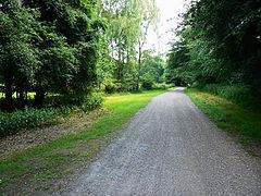 | ||
Savernake is a civil parish immediately south and southeast of Marlborough in Wiltshire, England. The settlements in the parish are the hamlets of Cadley and Clench Common. Savernake Forest covers the eastern half of the parish.
Contents
Map of Savernake, UK
History
Two Roman roads cross the parish, one from Mildenhall to Old Salisbury and the other between Cirencester and Winchester.
The eastern end of Wansdyke, an early medieval defensive earthwork, is in the northeast of the parish.
Cadley
The hamlet of Cadley (grid reference SU 207 665) is at the edge of Savernake Forest, on the A346 between Marlborough and Burbage.
An Anglican church, Christchurch, was built by T.H. Wyatt in 1851 for the Marquess of Ailesbury. It was closed in 1975 and declared redundant in 1979, then sold for residential use.
Clench Common
The hamlet of Clench Common (grid reference SU 172 656) is a small agricultural community in the northwest of the parish, on the A345 between Marlborough and Pewsey. It is 2 miles (3.2 km) north of the hamlet of Clench which is in Milton Lilbourne parish.
Clench Common Airfield is a grass strip about 1 mile (1.6 km) east of the hamlet, used by microlight aircraft.
Local government
The parish elects a parish council. It is in the area of Wiltshire Council unitary authority, which is responsible for all significant local government functions.
Savernake parish was created in 1934, with boundary changes in 1987; predecessor parishes were North Savernake and South Savernake (with Brimslade and Cadley).
Canal
When the Kennet and Avon Canal was opened in 1810 it crossed the parish, which extended further south than the present-day parish. Wootton Top Lock was formerly known as Cadley Lock.
Railways
The Berks and Hants line, part of a Great Western Railway route from London to Devon and Cornwall, was built close to the canal in 1862. Savernake station (later Savernake Low Level) was beyond the southeast border of the parish, towards Burbage. This station closed in 1966 but the line remains open; the nearest stations are at Bedwyn and Pewsey.
A branch - the Marlborough Railway - between Savernake Low Level and Marlborough was built through the parish in 1864. In 1896 the Swindon, Marlborough and Andover Railway built another line between a second Marlborough station and a second Savernake station, Savernake High Level, near to the first. The original branch line closed in 1933, the High Level station closed in 1961 and Low Level (by then renamed Savernake for Marlborough) in 1966; the line was later removed.
During World War II a large ammunition store was established north of Savernake station, with sidings for rail to road transfer.
Schools
A National School was opened at Cadley in 1850. It closed owing to low numbers of pupils in 1939. Today the local schools are at Marlborough, Burbage and St Katharines (near Tottenham House, just over the boundary with Great Bedwyn parish).