
 | ||
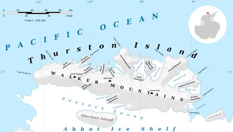
Savage Glacier (72°28′S 96°9′W) is a glacier at the east end of Thurston Island, lying south of Tierney Peninsula and flowing east to Seraph Bay. Discovered on helicopter flights from the USS Glacier and Burton Island by personnel of the U.S. Navy Bellingshausen Sea Expedition in February 1960. Named by Advisory Committee on Antarctic Names (US-ACAN) for Lieutenant John Savage, U.S. Navy, Dental Officer aboard the Glacier who assisted in establishing geodetic control points in the area.
Contents
Map of Savage Glacier, Antarctica
Maps
This article incorporates public domain material from the United States Geological Survey document "Savage Glacier" (content from the Geographic Names Information System).
References
Savage Glacier Wikipedia(Text) CC BY-SA