
 | ||
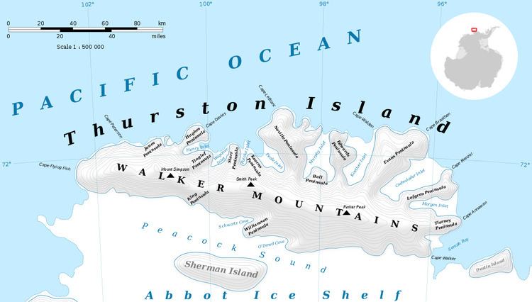
Tierney Peninsula (72°23′S 95°46′W) is an ice-covered peninsula about 14 nautical miles (26 km) long, between Savage Glacier and Morgan Inlet in the east end of Thurston Island. Discovered on helicopter flights from the USS Burton Island and Glacier of the U.S. Navy Bellingshausen Sea Expedition in February 1960. Named by Advisory Committee on Antarctic Names (US-ACAN) for J.Q. Tierney, oceanographer aboard the Burton Island on this expedition.
Maps
This article incorporates public domain material from the United States Geological Survey document "Tierney Peninsula" (content from the Geographic Names Information System).
References
Tierney Peninsula Wikipedia(Text) CC BY-SA