
Elevation 650 m (2,130 ft) Area 451,598 km² | Microregion Sudoeste de Goiás Time zone BRT/BRST (UTC-3/-2) Local time Wednesday 3:55 AM | |
 | ||
Weather 22°C, Wind S at 5 km/h, 93% Humidity | ||
Santo Antônio da Barra is a municipality in southwest Goiás state, Brazil. The population was 4,544 (2005 estimate) in a total area of 451.6 km². The elevation of the municipal seat is 650 meters. Santo Antônio is a large producer of poultry.
Contents
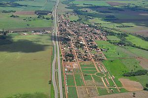
- Map of Santo AntC3B4nio da Barra State of GoiC3A1s Brazil
- Location
- Geographical information
- History
- Political and Demographic Information
- Economic information
- Education 2006and Health 2007
- References
Map of Santo Ant%C3%B4nio da Barra - State of Goi%C3%A1s, Brazil
Location
Santo Antônio is 190 kilometers from the state capital, Goiânia and is part of the Sudoeste de Goiás Microregion. The highway connection from Goiânia is BR-060. It has boundaries with the following municipalities:
Geographical information
The climate is moist tropical with high night-time temperatures. The rainy season is from October to March and the dry season is from April to September. Because of the hot and dry climate, the main vegetation is sparse cerrado. In the valleys there are still forests with sucupira, aroeira, pindaíba and other species of trees.
Santo Antônio da Barra is bathed by a vast river network, formed by the Verdão, which separates the municipality from Acreúna and Paraúna; Verdinho, on the border with Rio Verde; and Ribeirão Lage, which forms the boundary with Santa Helena de Goiás.
Electric energy is furnished by the Hidrelétrica de Cachoeira Dourada, on the Paranaíba.
History
Occupation of the region began in 1951 when Joaquim Domingos da Silva and his wife Alventina Borges da Silva fixed a cross in devotion to Santo Antônio. In 1963 the settlement was elevated to the status of district of Rio Verde The first municipal school, Escola Municipal Antônio Gouvêia de Morais, was built in 1976 with the secondary school, Irmãos Messias da Costa, being built in 1983. Finally, after a plebiscite, the district was emancipated and became a municipality in 1992.
Political and Demographic Information
Economic information
The economy is based on subsistence agriculture, cattle raising, services, public administration, and small transformation industries. IN 2006 there were 41 agricultural units with 9,219 hectares, of which 3,090 were planted in crops. About 150 persons were employed in agriculture. The largest employer in the town was public service with 385 persons in 2006.
Education (2006)and Health (2007)
Municipal Human Development Index
Data are from 2000
For the complete list see Frigoletto.com